Take the Trail
Start at the corner of Prospect Road and Barton Terrace West.
This Trail is about 2.5 km long and will take about two hours to complete.
It traverses traditional lands of the Kaurna people.
Start this trail at the corner of Prospect Road and Barton Terrace West (Spot #1 on the map above). The route is about 2.5 km and it will take about two hours to complete. Walking instructions are designated by bold type at the end of each of the 16 stop descriptions.
Optional: download and print a tri-fold leaflet, i.e. a double-sided single A4 page with a brief summary of this Trail Guide: (PDF, 1.7 Mb).
1. Park 2 introduction
Begin this Trail at the corner of Prospect Road and Barton Terrace West, opposite the Caledonian Hotel. Although the Park is best known for the Adelaide Aquatic Centre, there is much more to Denise Norton Park.
The Park is a multi-use park with various sporting and picnic facilities, exercise equipment, the Bush Magic Playground, and open spaces for both formal and informal activities including tennis, basketball, cricket, cycling, and social gatherings. Swimming has long been associated with this Park and is due to return in a new Aquatic Centre by March 2026.
This Park is located on the northern edge of the Adelaide Park Lands in North Adelaide and is bounded by Barton Terrace West, Prospect Road, Fitzroy Terrace, and Jeffcott Road.
The Park is about 17.8 hectares in size, which is around 11 times as large as the playing surface of Adelaide Oval. But in the context of the entire Adelaide Park Lands, this Park makes up only about 2 percent of the total area.
Similar to most areas of the Park Lands, this Park has three different names.
In the late 1880s, all the Parks were assigned numbers; so for well over a century this Park has been known as Park 2. The Kaurna name, ‘Pardipardinyilla’, which was assigned by the Adelaide City Council in 2002, translates to ‘swimming place’.
An Adelaide Swimming Centre was established in this Park back in 1969. Hence the name “swimming place” was deemed appropriate.
The English name of the Park, ‘Denise Norton Park’ was assigned only in 2017.
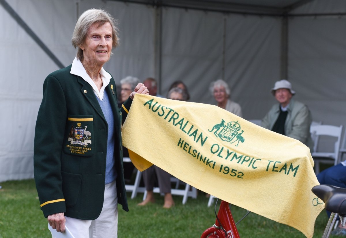
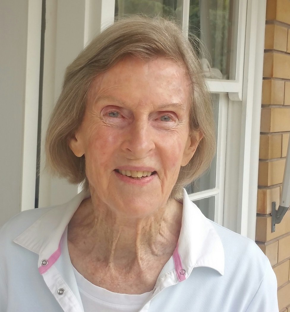
Denise Norton was the first South Australian female athlete to represent Australia at the Olympic Games. She made her Olynpic Debut in the 1952 games in Helsinki, Finland at the age of 18. She also participated in the 1950 British Empire Games (later known as the Commonwealth Games) where she won a gold medal in the 4 x 100-yard freestyle relay and bronze in the 440-yard freestyle.
The City Council held a ceremony here in 2019 to honour Denise Norton. This is the only one of the Parks within the Adelaide Park Lands to have been named after a living person.
Caledonian Hotel
The Caledonian Hotel, located on the corner of O’Connell Street and Barton Terrace West was established in 1869.
As it was rare for single storey hotels to be built or established after the mid-1850s, the Caledonian Hotel remains as one of the only two-single storey hotels, with the other being the Queen’s Head Hotel on Kermode Street. The hotel is also one of only four hotels, licensed between 1870 and 1900 that were still trading in 2025.
Caledonian Hotel, pictured 1913. State Library of SA B-10294
In 1878, a horse tram terminus was constructed opposite the Caledonian, which increased trade and business for the hotel. The increased traffic from the tram activity resulted in an expansion and renovation of the hotel in 1883.
From this point, walk north-west along the paved pathway. Stop under the pine trees, before you get to the construction fences.
2. Layout of pathways
.
The early European settlers when they started the colony of South Australia had very little regard for the Adelaide Park Lands. In the first three decades after settlement, the colonists had cleared almost every single tree from the Park Lands.
They were chopped down for firewood, for fence posts and for construction.
Eventually the City Council of the day decided to do something about it and they hired a Scottish forestry expert to come to Adelaide and make a plan for how to re-green the Adelaide Park Lands.
The expert was named John Ednie Brown and he literally wrote the book on how to re-vegetate the Park Lands. The book was published in 1880. John Ednie Brown didn’t stay around for very long after his report was produced, but the City of Adelaide basically followed John Ednie Brown’s plan for decades afterwards, at least until the 1930s.
Most of the Park Lands are still laid out in a manner similar to the plans specified by Brown in his 1880 Report. There’s also part of the Park Lands named after him; J.E. Brown Park (Park 27A) which is in the north-west part of your Park Lands.
This pathway you can see here was one of the many pathways suggested by Brown. He was fond of diagonal pathways cutting through Parks, inviting people to walk through the Park.
John Ednie Brown’s plan for Parks 2 and 3.
About 16 years after John Brown had left Adelaide (that is, in 1899) a new City Gardener, August Pelzer was appointed. Using Brown’s Report as a guide, Pelzer commenced a meticulous planting program of the Park Lands.
Pelzer adopted this northwest to the southeast pathway as the core feature and main pathway of this Park 2.
Other diagonal and cross-axial pathways were gradually added, seemingly based on pedestrian and community ‘desire lines’.
The main pathway of the Park is lined by a row of Aleppo Pines (Pinus halepensis) and Radiata Pines (Pinus radiata).
From this point, walk back towards the street, and look for a row of six houses, numbered 101 to 109 Barton Terrace West.
3. Heritage houses
The houses numbered 101 to 109 Barton Terrace West, comprise three duplex town-houses.
They were built in 1902 by Walter Stephenson, who was the Melbourne-based owner of an Adelaide jewellery store.
The houses are in the “Queen Anne” style, each pair with the same design. All six houses were purchased by a consortium of doctors in 1920 and were converted into the “Ru Rua” private hospital. Ru Rua is a Maori phrase meaning “both equally”.
In 1982-83 the buildings were converted back into six separate houses. They retain many historic features such as stained glass windows, timber stair balustrades and sandstone brick all the way around.
101 Barton Terrace West (four doors west from the Caledonian Hotel) was sold in June 2022 for $2.7 million.
Pic: Google Streetview, captured August 2023
Along the Southern edge of the Park, along Barton Terrace West, there is a line of Moreton Bay Figs (ficus macrocarpa) which were planted in the 1880’s.
The Moreton Bay Fig is a rainforest tree that can grow up to 50 metres tall when planted in the open in certain climates. The tree is typically planted as an avenue of shade trees around farms and parks such as this one.
The tree is usually identifiable by its large and distinct buttress roots that can spread as wide as its height. The tree also produces fruits that turn from yellow to purple.
Unfortunately, due to the limestone layers and poor soil quality of the Park, the local Fig trees are in a poor condition. They are small compared to the huge ones in Botanic Park and the Adelaide Botanic Garden.
Interspersed between the Moreton Bay fig trees, along the edge of the Park, are several large Kurrajong trees (Brachychiton populneus) and Norfolk Island Hibiscus (Lagerstroemia patersonii).
From here, walk to the corner of Barton Terrace West and Jeffcott Road. Try to look through any keyhole gap in the construction fence.
Just before you reach the corner you will see a large Desert Ash tree (Fraxinus angustifolia) opposite #131 Barton Tce West.
4. New Aquatic Centre
This site was the subject of an almost two-year long campaign by the Adelaide Park Lands Association.
The State Government is spending $135 million to build a new regional Aquatic Centre for Adelaide's central and inner-northern suburbs.
The Government could have chosen any brownfield site to build the centre. However it chose a new location, here, immediately south of the former Aquatic Centre.
In choosing this site, the State Government ignored more than 8,000 signatures on a petition, urging them to save the dozens of trees that were at risk here. Despite our campaign and the size of the petition, the destruction began in November 2023.
Four broken promises
The decision to build here, rather than on a brownfield site, broke FOUR promises.
First, it broke a promise to consult the public on the proposed location. The Government did not allow anyone to suggest a site other than in this Park.
Second, it broke a promise to protect and restore Adelaide’s tree canopy. To use this site, Government contractors destroyed dozens of mature trees, that were providing habitat for possums, koalas, and many bird species.
Third, it broke a promise to keep the old centre operating while the new centre was being built; and
Fourth, it broke a promise that the new centre would be smaller than the old one to return land to your Park Lands. The fenced area around the new centre will be much larger than the fenced area around the former Aquatic Centre.
A report from Government-hired consultants, Succession Ecology, in 2022, found that construction at this site would be "highly likely" to disturb habitat of:
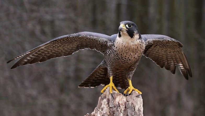
Peregrine Falcons; which have been observed to breed within 5km of the site;
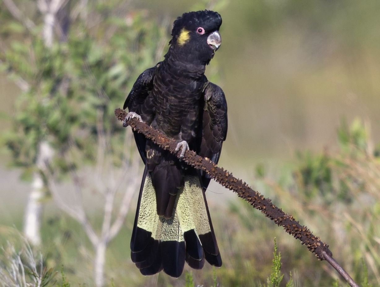
Yellowtailed Black Cockatoos, which feed on the pines here;
Grey-headed flying foxes, which forage for food here; and the
Brushtail possums, which were nesting in some of the large old trees which the State Government approved for destruction.
The trees destroyed by this project included large mature open woodland trees: the Sugar Gums (Eucalyptus cladocalyx) which provided occasional habitat for koalas, as well as River Red Gums (Eucalyptus camaldulensis) which were planted between 1880 and 1900.
Before the destruction: A koala in one of the Sugar Gum trees (Eucalyptus cladocalyx) off Jeffcott Road. In late 2024 this tree had been retained, but was within the demolition compound of the former Aquatic Centre.
Others that were felled in November 2023 included Radiata Pines (Pinus radiata) and Aleppo Pines (Pinus halepensis) and Canary Island Pines (Pinus canariensis), which date back to the 1920s or earlier.
You can read about this project and our almost two-year long campaign to save these trees, at this page: https://www.adelaide-parklands.asn.au/new-aquatic
From this point, cross over Jeffcott Road, stick to the side of the road, and stop at the first tree you can see on the right-hand side of the path, before you get to number 149 Barton Terrace West.
5. Queen’s college & rose beds
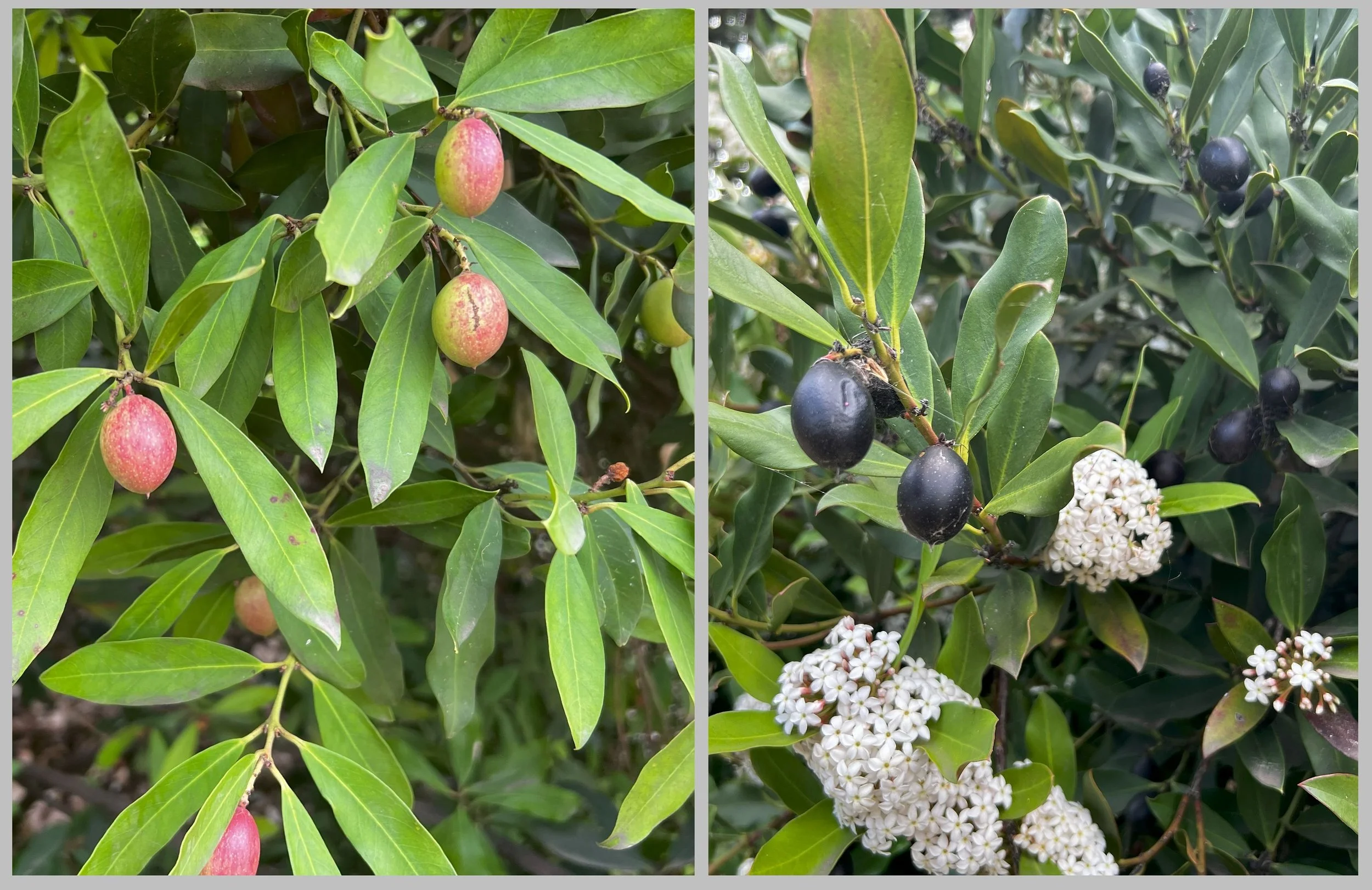
Alongside the path is a large Dune poison-bush (Acokanthera oblongifolia) native to South Africa. Its fruits have been used in traditional African medicine for snakebites, itches and intestinal worms. Although they look delicious, don’t be tempted to eat the berries! All parts of the plant are toxic and it’s been used to create poison arrows!
The Dune poison-bush off Barton Terrace West in winter (left) and in summer (right).
Walk a few metres further and look across the road to 149 Barton Terrace West.
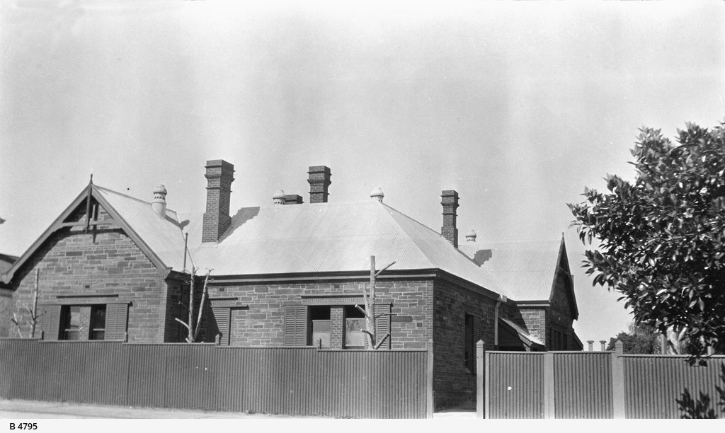
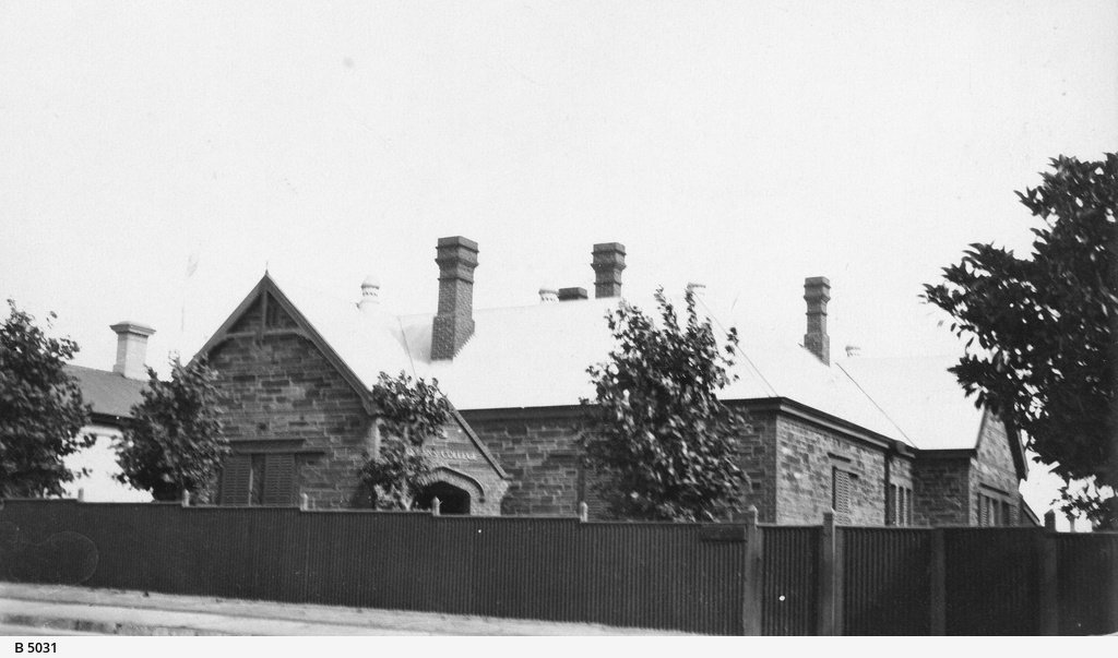
This building was known for many years as the Queen’s School (and then later as Queen’s College) .
The building was designed in 1892 by E.J Naish, who also designed the University of Adelaide’s Elder Hall and the Ambassadors Hotel on King William Street. The school building resembles a household building as its design is reminiscent of a late nineteenth-century villa.
Several students of Queen’s College later went on to critical acclaim and success in their field of knowledge. Sir William Lawrence Bragg was a world-renowned physicist and was the youngest Nobel prize recipient for his contribution to the development of X-ray crystallography.
Other notable scholars include Professor Walter Geoffrey Duffield who was the first director of the Commonwealth Solar Observatory (later named as the Mount Stromlo Observatory) near Canberra. Queens College also educated the Smith brothers, Sir Keith and Ross Smith who were the first people to fly from London to Australia.
Unfortunately, as with most schools during the Depression in the 1930s, Queen’s College faced financial hardships and obstacles. Despite community-led fundraisers and a proposal to purchase the school, the College was shut in 1949. Today, the former College building is a private dwelling.
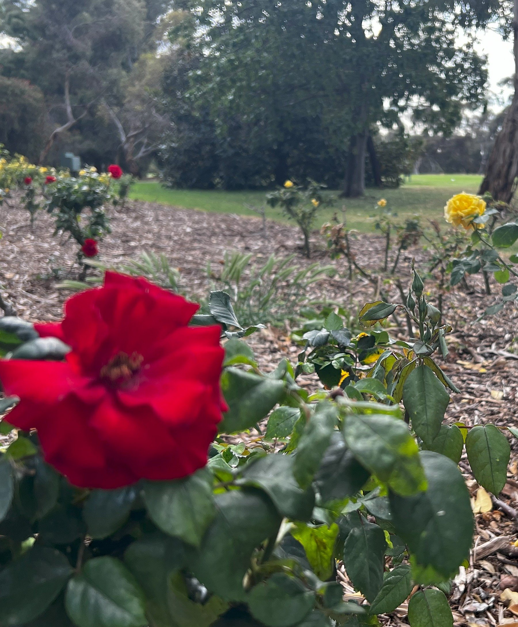
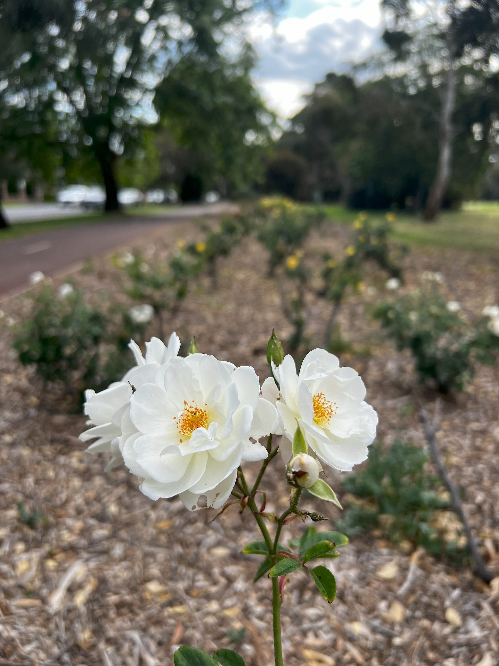
Opposite the former Queen’s college is a long-standing rose bed. In season, there are red, yellow and white varities.
From here, walk a few metres further downhill until you see a metal cage with water pumping equipment. Stop there, and walk a few metres to your right, into the Park, where you will see the 13th tee of the North Course, and the 13th fairway, downhill from here.
6. Golf - north course
Park 1 is most known for its golf courses. There is not just one course. There are three.
At the time of writing, all three of the North Adelaide golf courses were managed by the City of Adelaide.
However in June 2025, the State Government passed legislation to take over the entirety of Possum Park; and also John E Brown Park (Park 27A), to “re-develop” golfing facilities for the purposes of the professional LIV Golf circuit.
Nevertheless, all three golf courses are part of your Park Lands, and part of Possum Park / Pirltawardli (Park 1). Because it’s all “Open, Green, Public” you do not have to pay to enter the course. However there are signs advising that you to keep off the manicured greens, and the tees, which are reserved for golfers who’ve paid the green fees for their round.
At this northern end of Park 1, you are on the edge of the North course. This Trail Guide continues downhill, beside the North Hole 14 fairway, where the map below shows “on road parking”.
The numbering on this published map is out of date. The fairways were renumbered in 2025, so that the one marked N14 is now #13. Fairway N9 is now #7.
You don’t have to be a member of a golf club to play here, because it’s a public course. But you can of course join a club.
The largest golf course is the South Course, which measures 5.9 kilometres in length and is Par 71. It hosts many golf competitions, including the prestigious Lord Mayor’s Golf Trophy each year in April. This, the North Course, is shorter, measuring 4.5 km, and is rated easier, being Par 68. The City Council says that the North Course is “ideal for new golfers or those wanting a quick round.”
Walking downhill alongside Barton Terrace West you are adjacent to the 13th (formerly 14th) fairway. Golfers are advised how to play this hole:
A picturesque downhill Par 4, of 316 metres in length. Drives will roll for a good distance if they find the fairway. A large green is well guarded short right and to the left forcing players to be precise on not only direction but also club choice. A good hole where birdie is just as easy as double bogey.
This area might not remain a golf course in future.
After passing legislation in June 2025, the State Government’s plans for re-development might not include two separate full-length golf courses, and some of the North Course might be repurposed.
Earlier, in late 2024, the City-Council approved Park Lands Management Strategy “Towards 2036” called for an investigation of “an alternative Park Lands Purpose for all or part of the northern section of the North Adelaide Golf Course” (p.96)
From this point, walk down the hill, past two bends in the footpath, and past a huge lemon-scented gum tree. Stop opposite #193 Barton Terrace West, where there are a number of large, green leafy bushes, that are more than head height.
7. Biodiverity hotspot
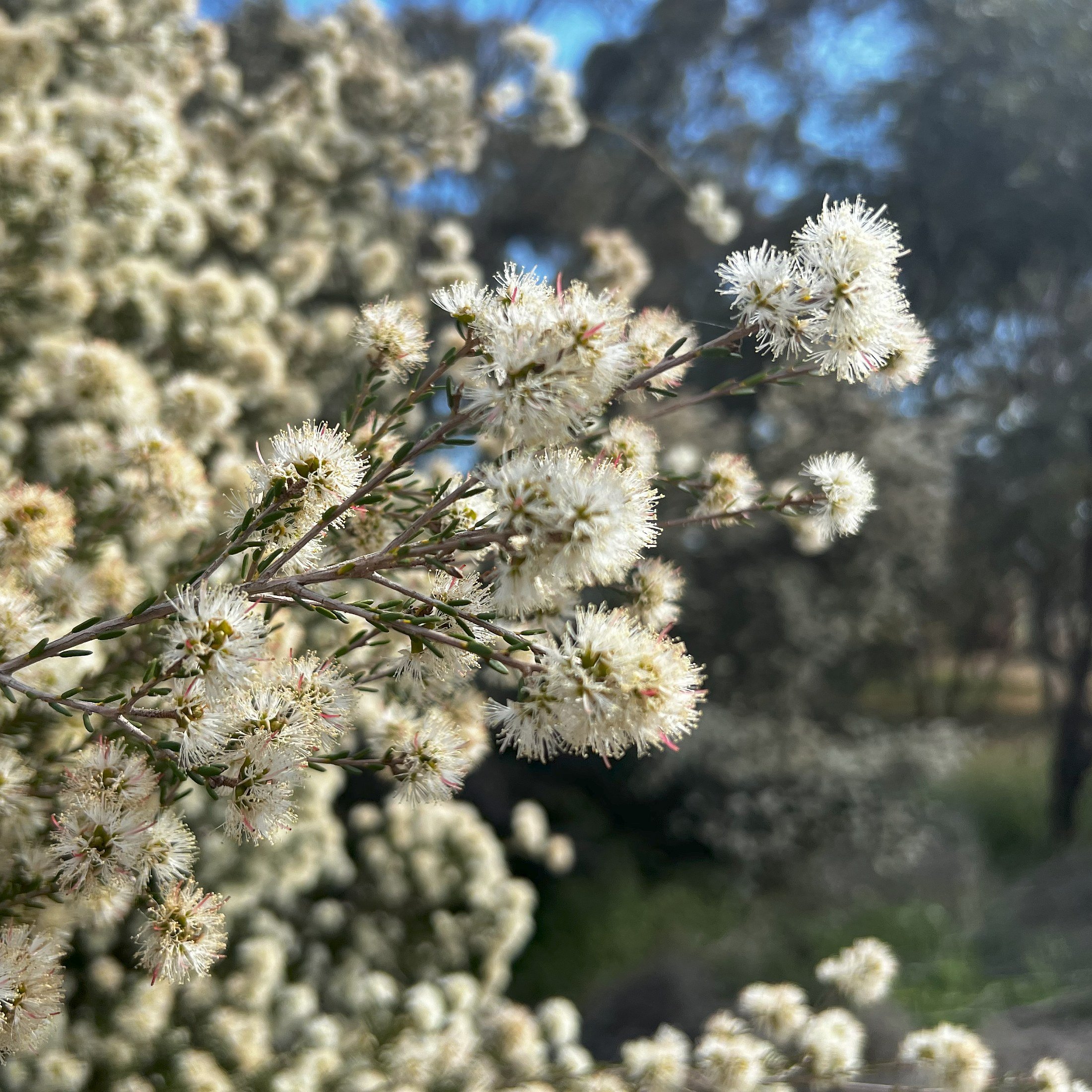
At this location, the green bushes here include a large Podocarp (an evergreen conifer) a Mediterranean Cypress, and a Showy Honey-myrtle (Melaleuca nesophilia).
This northern section of Possum Park / Pirltawardli (Park 1) has what might be the most diverse collection of shrubs and trees in any part of your Adelaide Park Lands.
After European settlement began in 1837, the early settlers devastated the Park Lands, chopping down almost every single tree, to use for firewood, fence posts and construction.
The ambition to re-green the Park Lands commenced in the 1860s but has been done inconsistently over time. This Park, like many other parts of the Park Lands, contains trees and bushes that have been introduced in fits and starts, during waves of enthusiasm at various time’s in Adelaide’s history.
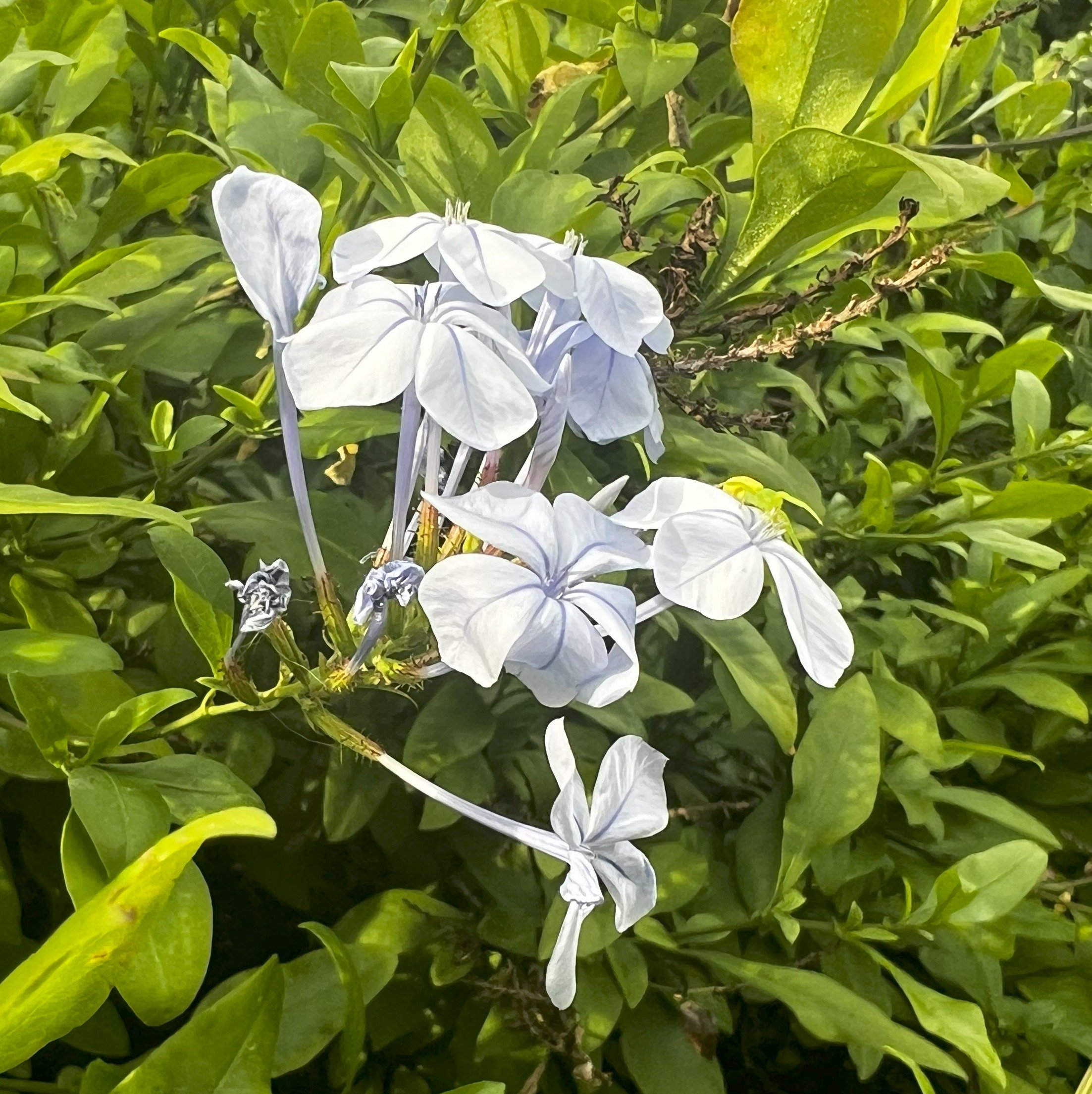
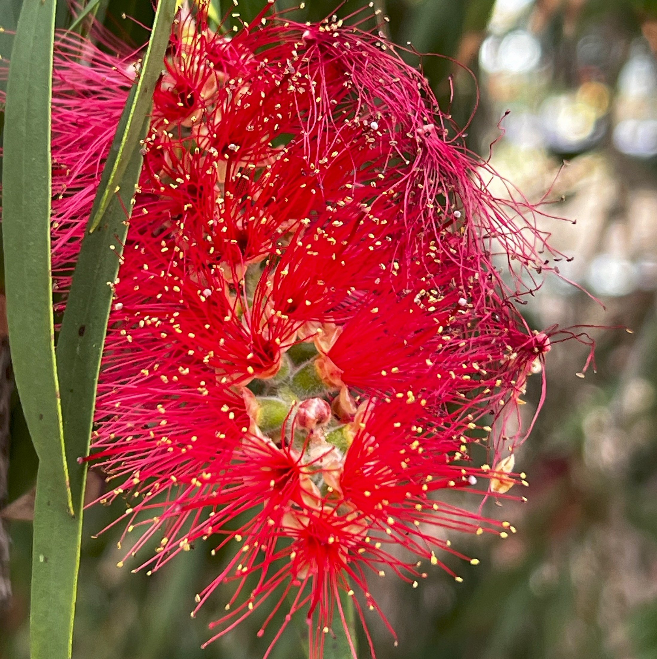
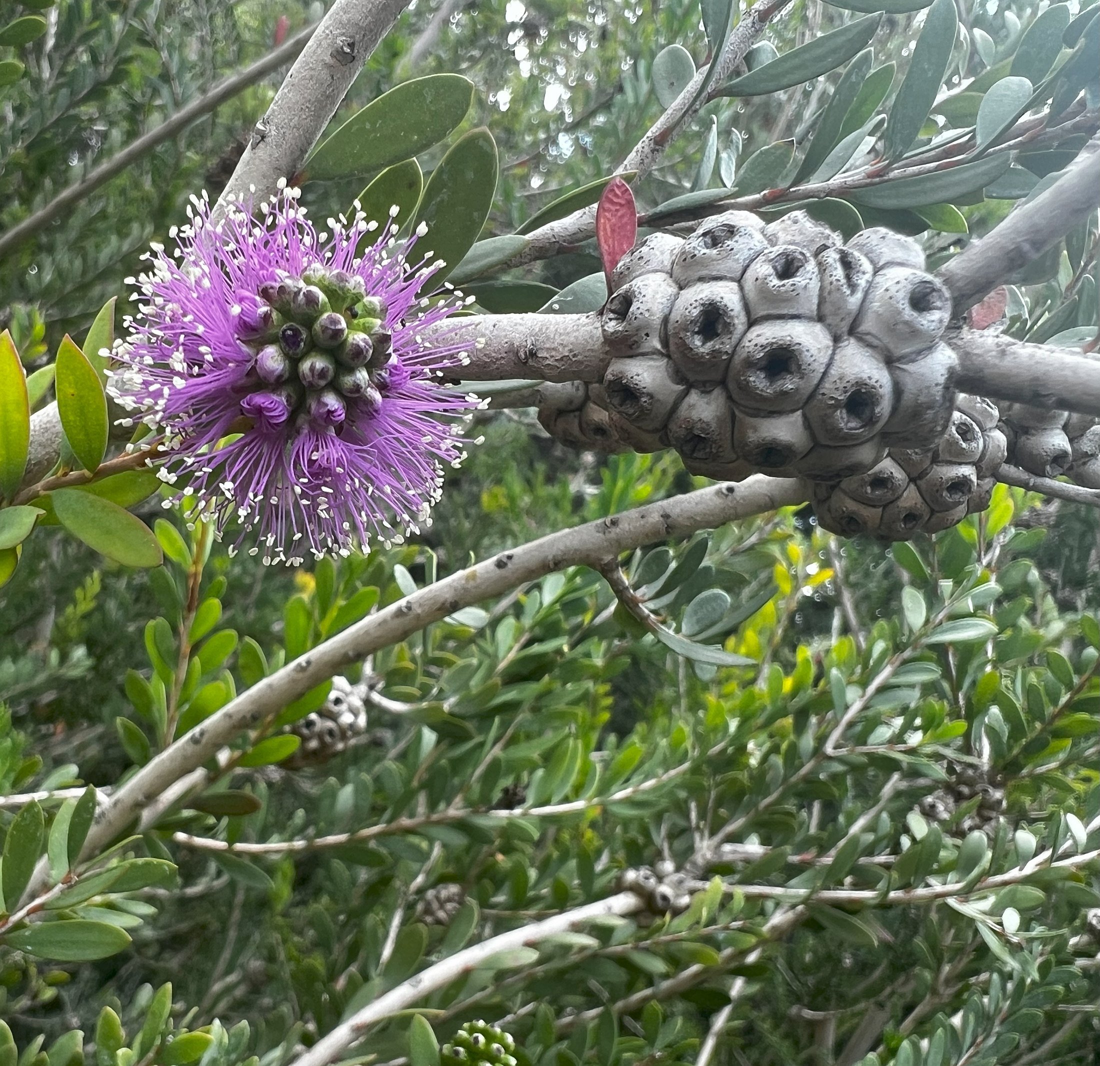
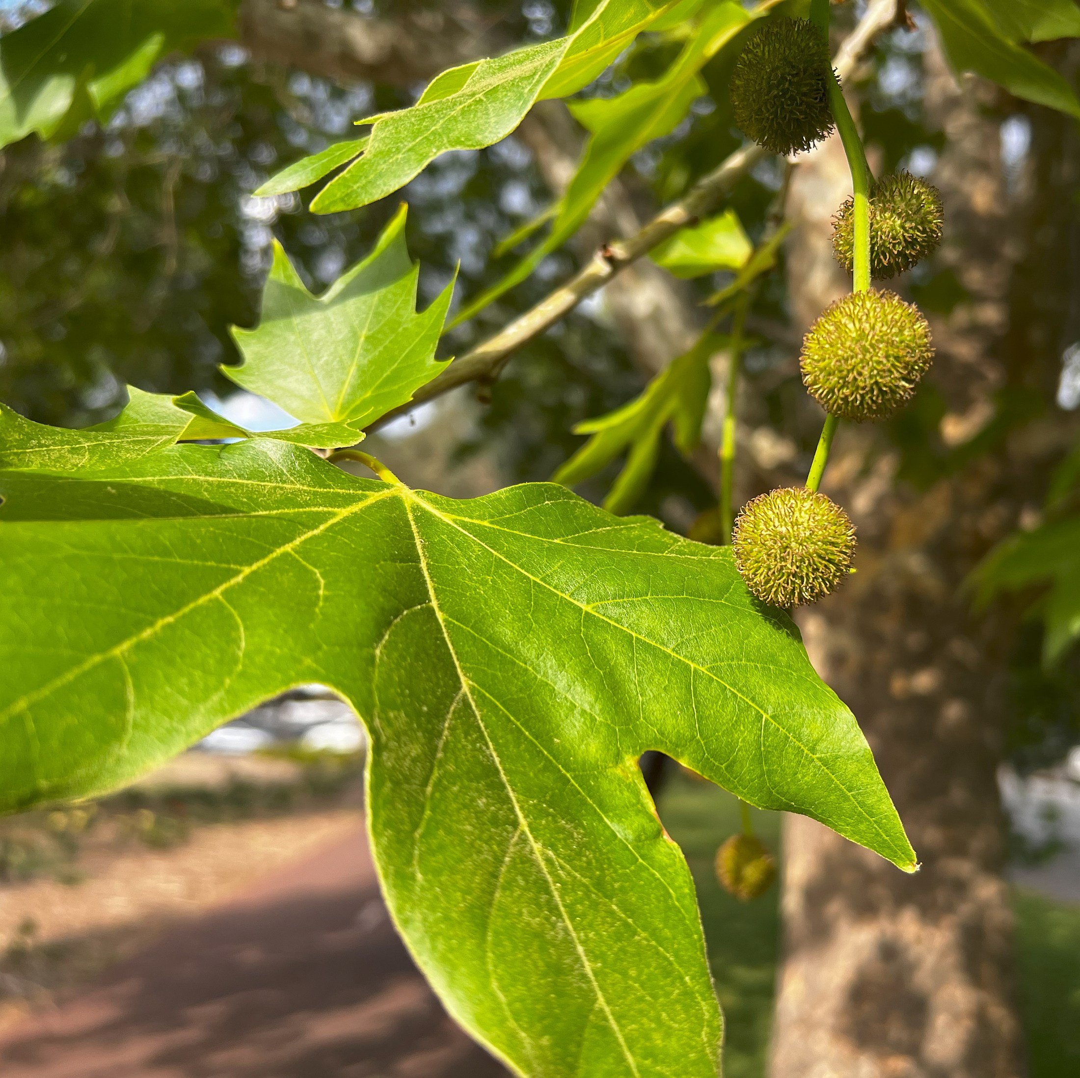
On this Trail, within this northern section of Park 1 alone, if you keep a sharp lookout, here are just some of the tree species you can see:
GUM TREEs
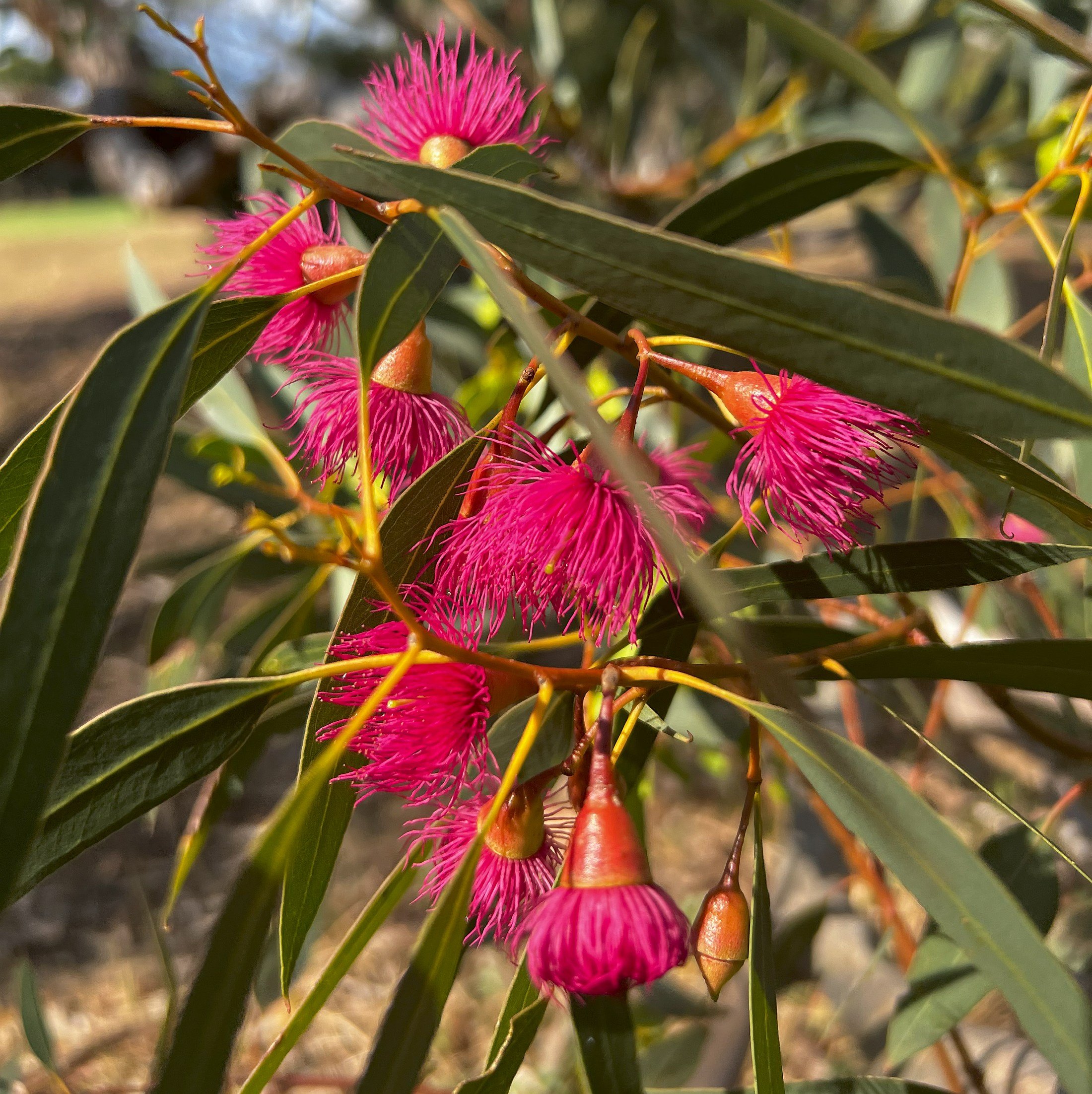
River red gum (Eucalyptus camaldulensis)
Red ironbark (Eucalyptis sideroxylon)
Sugar gum (Eucalyptus cladocalyx)
Lemon-scented gum (Corymbia citrodora)
Coral gum (Eucalyptus torquata)
Peppermint box (Eucalyptus odorata)
Yellow gum aka South Australian blue gum (Eucalyptus leucoxylon)
Spotted gum (Corymbia maculata)
OTHER AUSTRALIAN NATIVES - NOT NECESSARILY LOCAL TO THE adelaide areaShowy Honey-myrtle (Melaleuca nesophilia) (native to Western Australia)
Melaleuca (various species)
Swamp Sheoak (Casuarina glauca)
White cedar (Melia azedarach)
Kurrajong (Brachychiton populneus)
Bottle brush (Callistemon)
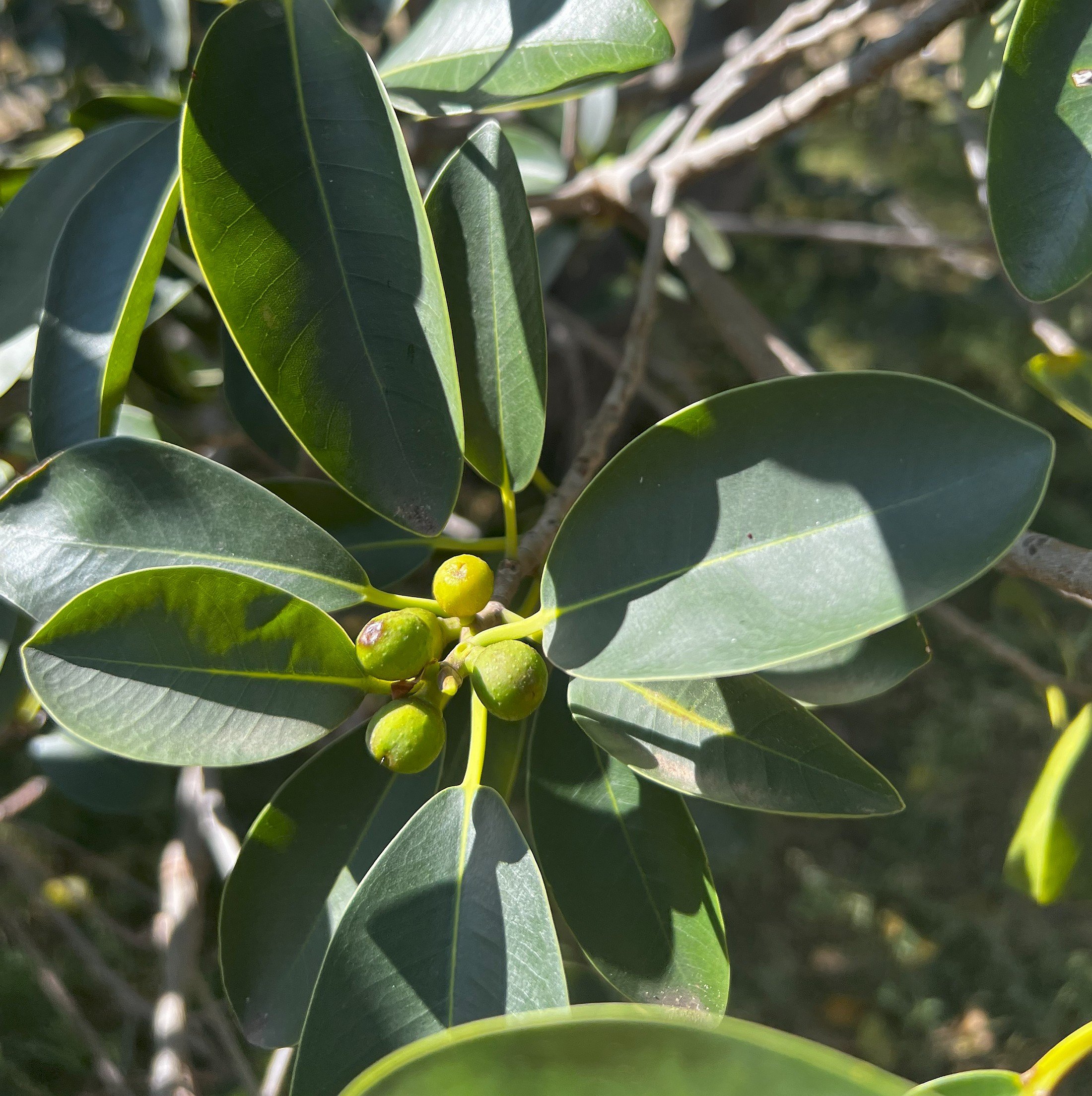
Port Jackson fig (Ficus rubiginosa)
Pine trees
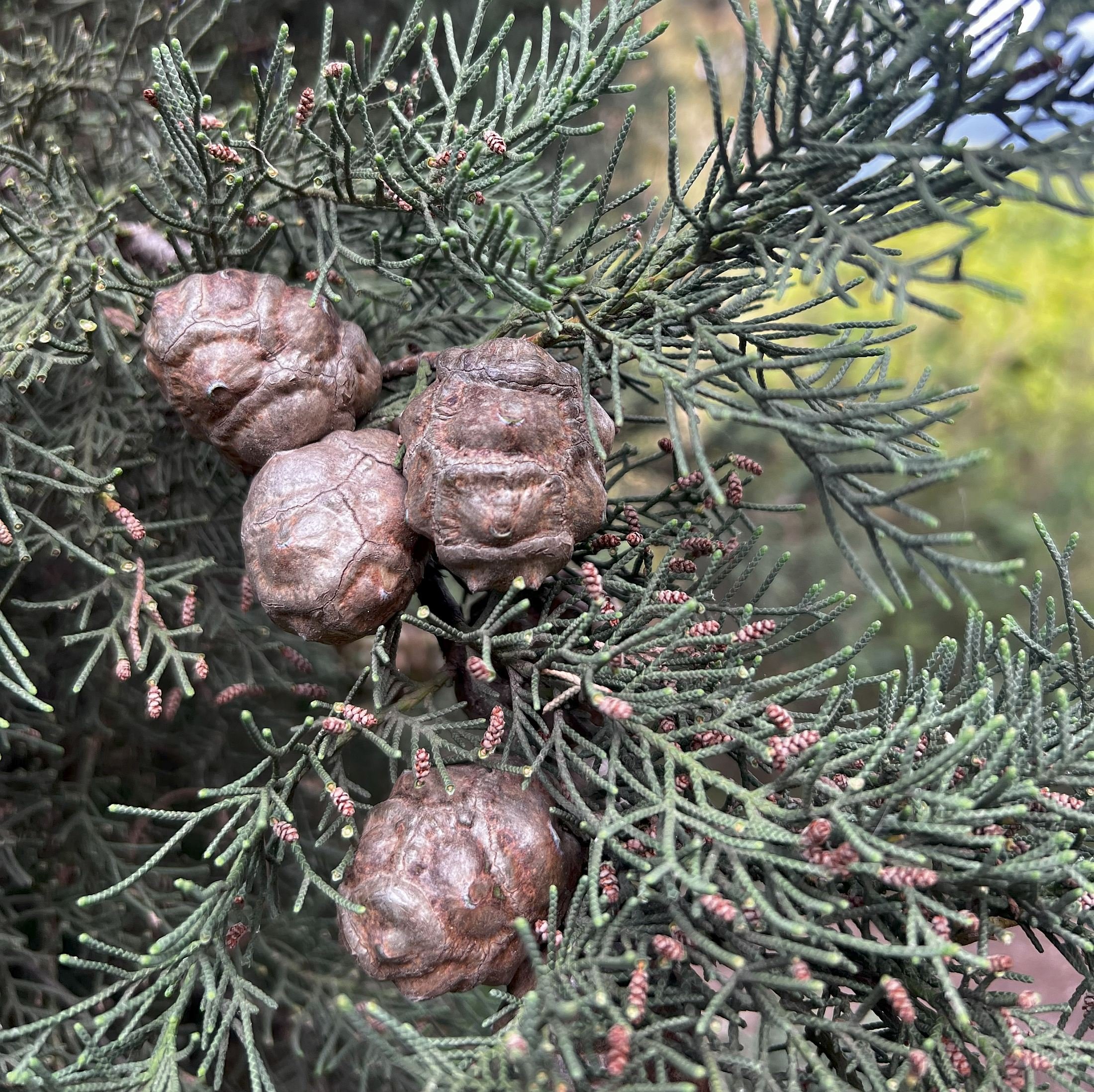
Native Pine (Callitris gracilis) (nztive to SA including the Adelaide region)
Canary Island pine (Pinus canariensis)
Aleppo pine (Pinus halepensis)
OTHER EXOTICS (I.E. NOT ORIGINALLY FROM AUSTRALIA)
Oriental Plane (Platanus orientalis)
Norfolk Island hibiscus (Lagunaria patersonia) (native to Norfolk Is & Lord Howe Island)
Coral tree (Erythrina) (native to South America)
Mediterranean Cypress (Cupressus sempervirens)
Carob (Ceratonia siliqua) (native to the eastern Mediterranean)
Pepper tree (Schinus molle) (native to South America)
Blue plumbago (Plumbago auriculata) (native to southern Africa - poisonous!)
Dune poison-bush (Acokanthera oblongifolia) (native to southern Africa - poisonous!)
This is probably an incomplete list.
From this point, walk further downhill to the intersection where a single-lane road meets at the corner.
8. Busway battle
This corner is the scene of one of the longest-running community and political battles in Adelaide’s history.
This road connects Mills Terrace and Barton Terrace West with War Memorial Drive, and around the corner to Hawker Street at Bowden.
Around the year 2001, the road was closed to regular traffic, while still allowing buses and cyclists to come through.
The restriction was put in place to reduce the volume of traffic using Barton Terrace West and Mills Terrace. This was welcomed by North Adelaide residents, but was not popular among residents of Bowden, Brompton and Croydon.
The local member of Parliament for the Croydon area was Michael Atkinson, who was (at the time) the State Attorney-General.
For more than 10 years, Mr Atkinson campaigned on behalf of his constituents to re-open this busway to all traffic.
The busway linking Mills Terrace and War Memorial Drive and (inset) former Attorney-General, Michael Atkinson.
He argued that the closure hindered access to medical facilities, schools and charities in North Adelaide. The argument was sometimes framed in terms of pitting the toffs of North Adelaide against the working-class people of the inner north-western suburbs.
Arguments against the closure also came from some obstetricians who advised that the road closure could delay critical response times to medical emergencies during childbirth at Calvary hospital.
The controversy at least partly reflected political divisions, between successive Liberal MPs who at the time represented the seat of Adelaide, against the Labor MP, Mr Atkinson, who represented Croydon.
After stepping aside from the position of Attorney-General and becoming a backbencher, Mr Atkinson put forward a Private Members Bill in State Parliament, with the sole aim of re-opening this road.
The Bill was not successful, and in 2025 the road remained closed to all traffic except buses and bicycles.
From here, walk downhill on a bitumen path beside the busway. Before you reach War Memorial Drive, turn right onto a light-coloured gravel path. Stop at the sign that points the way to the 7th tee.
9. Tall trees
At this point, you are below (just downhill) from a putting green and hole of the North Course, with its red-flagged pin.
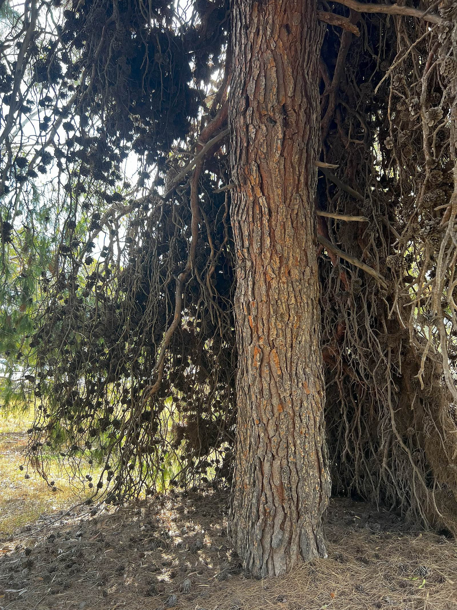
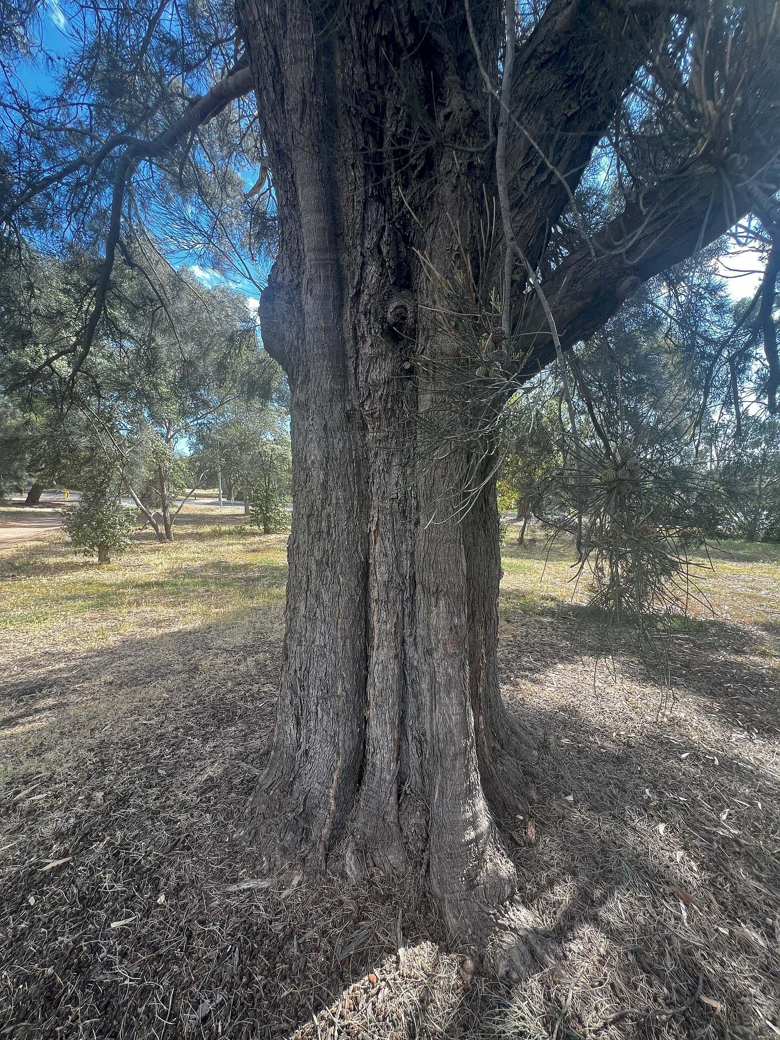
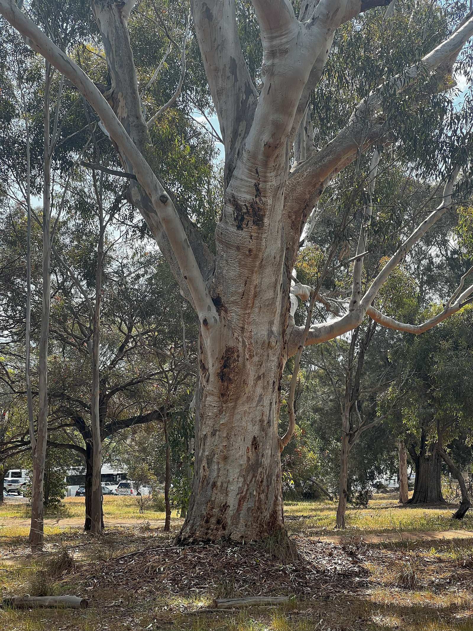
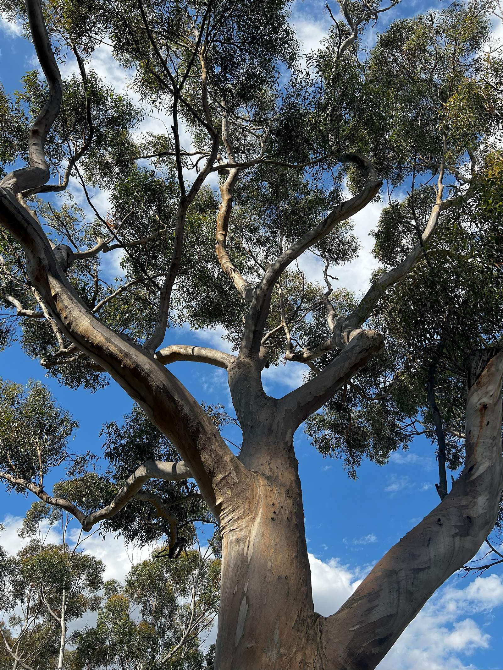
Take a moment to look around you, and try to identify some of the tall trees you can see here.
These photos will assist you:
From this point, go to the sign that says “Next Tee 30m”. Walk uphill, in-between a putting green on your right, and a tee on your left. Head towards three large Aleppo pine trees and keep walking up the hill, staying in the bush between the two golf fairways.
Keeping the (7th) fairway on your left, look for three large River Red gum trees on the opposite, other side (north side) of the fairway. At that point you will see something close to you, that appears to be a tree with a split personality.
10. Split personality
As you progress up the hill, between the two fairways, you will see a variety of mostly native eucalyptus trees, including Peppermint Box (Eucalyptus odorata), South Australian blue gum (Eucalyptus leucoxylon) and Round-leafed Moort (Eucalyptus platypus).
Photographed in October 2024: Seed pods and blossom on a South Australian blue gum (Eucalyptus leucoxylon) between the 7th and 9th fairways of the North Course, in the northern part of Possum Park / Pirltawardli (Park 1). Pics: Shane Sody
There’s also a couple of Port Jackson fig trees (Ficus rubiginosa). These should not be confused with the better-known Moreton Bay fig trees.
The Port Jackson fig is similar to the Moreton Bay fig. Both trees are rainforest trees that can grow very tall in open spaces and have large buttresses. Also, they are both usually used as shade trees in public parks and open spaces.
Where the trees differ is in the sizes of their leaves and fruits.
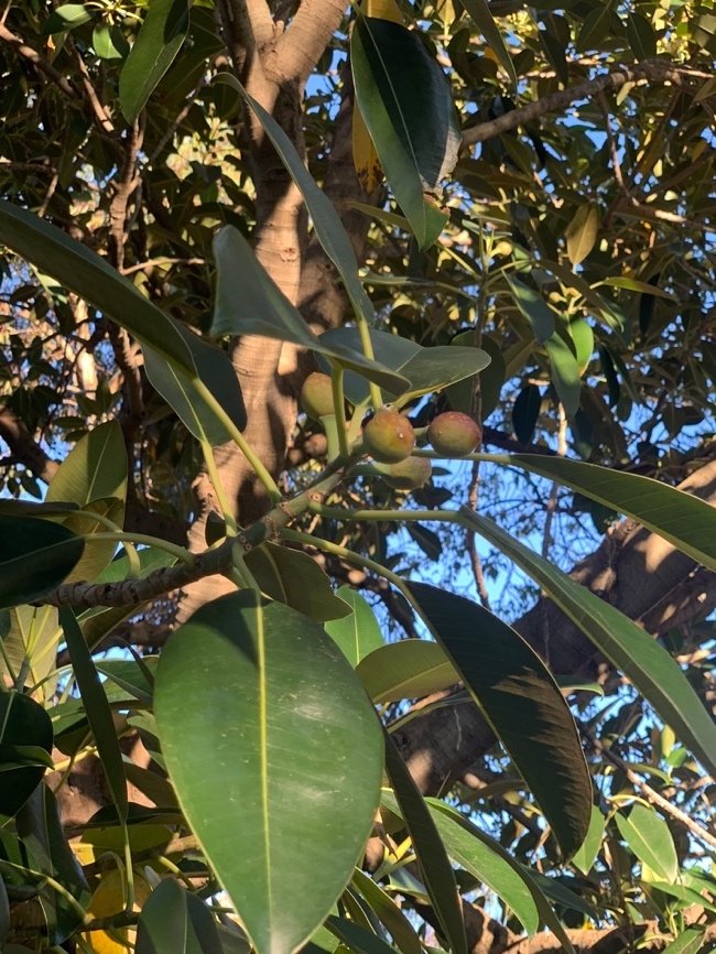
The leaves of the Port Jackson fig grow around 6-12 cm long and their fruits are usually 12-20 mm long. They are smaller compared to the Moreton Bay fig’s leaves that can grow up to 25 cm long and their fruits grow around 20-40 mm long. The smaller leaves of the Port Jackson fig stay green on both sides. The larger leaves of the Moreton Bay fig tree tend to go brown underneath.
Another notable difference is the colour of their fruits, The Port Jackson produces yellow to red fruits, which are usually slightly hairy, whereas the Moreton Bay fig produces yellow to purple fruits.
Photographed in October 2024: Leaves and fruit on a Port Jackson fig tree (Ficus rubiginosa) between the 7th and 9th fairways of the North Course, in the northern part of Possum Park / Pirltawardli (Park 1). Pics: Shane Sody
On the southern edge of the 7th fairway, about halfway up the hill towards Jeffcott Road you will come across what appears to be a tree that is half a eucalyptus, and half a pine tree.
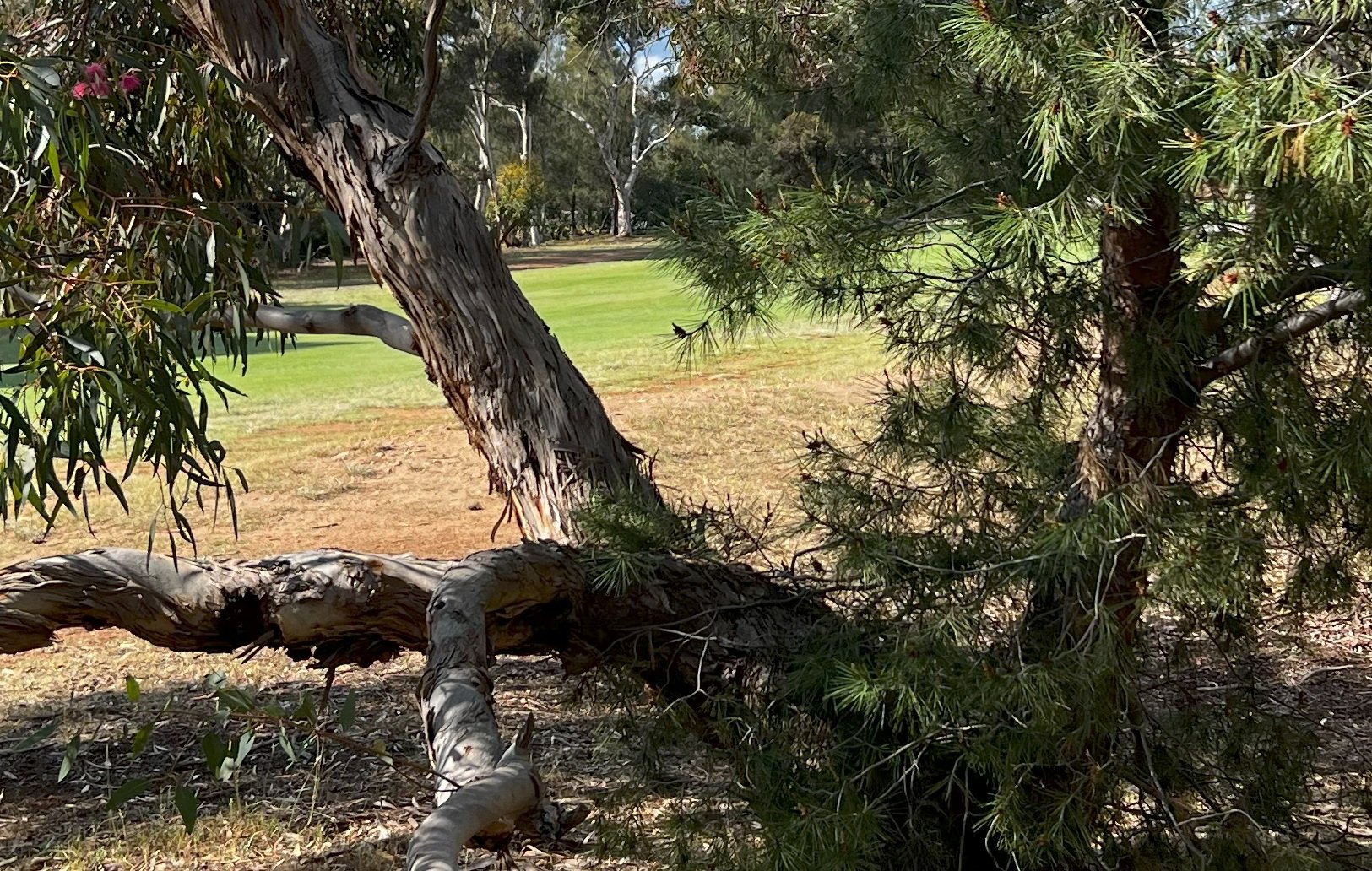
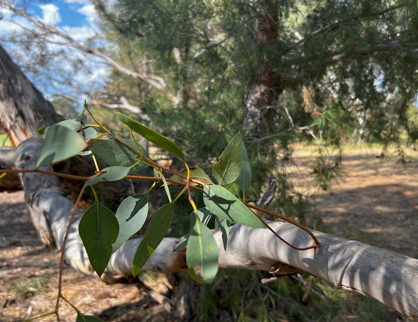
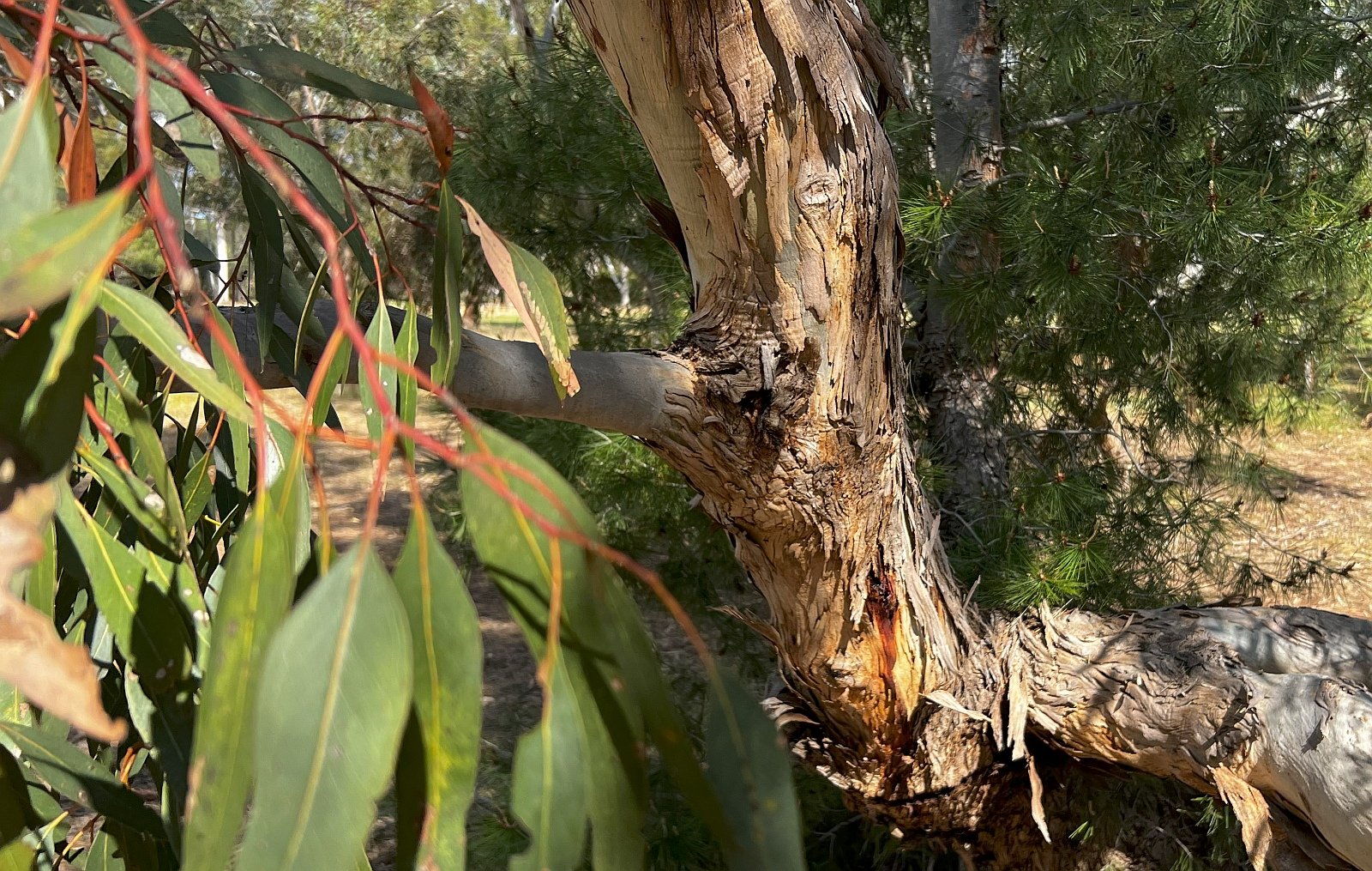
You have to look very closely, and walk around on all sides to realise that what you can see are two trees growing very closely together. From most angles they appear to be a single tree with a split personality!
From here, keep walking up the hill, through the bush between the two golf fairways, and cross over Jeffcott Road to return to Park 2, at the site of the former Adelaide Aquatic Centre.
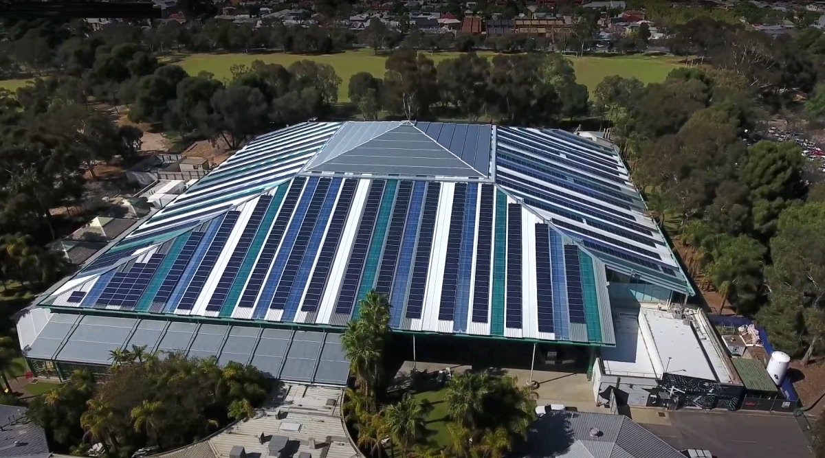
11. Former aquatic Centre
.
During the nineteenth century, personal hygiene and cleanliness had only started to be recognised as vital factors in the control of diseases. Before bathrooms were a common feature in houses, people used to bathe in the ocean, rivers and natural swimming holes to keep clean and cool down.
In 1854, public meetings were held with a group of concerned citizens to discuss the potential establishment of public baths in Adelaide. After much debate and deliberation regarding the location and funding of the baths, they were opened on 21 December 1861 under the control and management of the Council.
The baths were located on King William Road, beside the Parliament House and opposite the Government House. Although the baths were built primarily for health and sanitary reasons, swimming was an added secondary benefit. In 1969, the baths were demolished and the site is currently occupied by the Festival Plaza.
In the 1960s swimming had become a popular leisure and sporting activity in Australia. The national teams were also winning gold in international swimming competitions. Therefore, the Council did not want to get rid of a pool without replacing it with another.
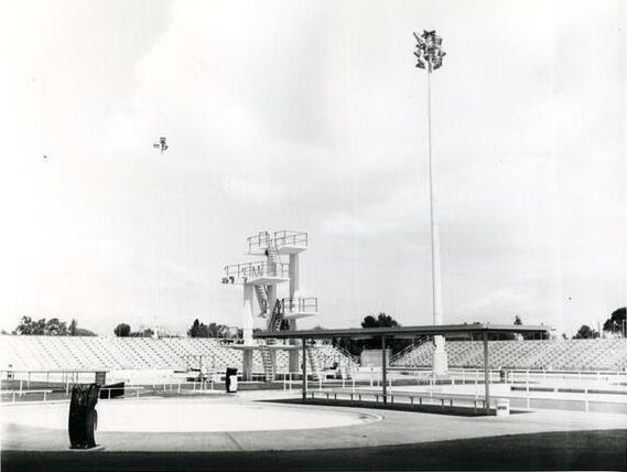
As the Park Lands were available for recreational and sporting purposes, the Council decided to build the Adelaide Swimming Centre in this park. The centre opened on 20 December 1969. The Swimming Centre consisted of three pools with a diving tower.
The establishment of the Swimming Centre was initially met with disapproval and criticism from some of the residents of North Adelaide. Some called it “an environmental disaster.”
Concerns were also raised regarding potential traffic and parking issues, that the sight of a large Olympic size pool and diving tower in the middle of the Park would look out of place, and the noise from the open Swimming Centre would disturb the residents and lower the value of the surrounding properties.
In 1985, the Centre received a major makeover. The pools were enclosed and covered by a glass-like pyramid structure which cost $8.25 million. The structure was designed by Hassell Architects and was reminiscent of what was called, at the time, the “Adelaide Regionalist architectural style.”
The transformation of the Aquatic Centre drew more mixed reactions from the residents of North Adelaide. Residents that lived nearby the Centre were pleased that the noise from the pools and loudspeakers were now contained. Meanwhile, other residents were worried about the further alienation of more Park Land as additional parking spaces were built.
The change from an outdoor Swimming Centre to an indoor Aquatic Centre made the pools less accessible to the public, which drew criticisms from recreational swimmers who were unhappy with the emphasis on competitive swimming at the expense of public use.
The Aquatic Centre was renovated again in 1998. Designed by architect Ricky Brown and Ian Barwick, many of the Centre’s original facilities and features were rebuilt and updated.
In 2022, the State Government promised that the former Aquatic Centre would remain open until a new centre was constructed immediately to the south of it.
However that promise was broken when the centre closed at the end of August 2024. Demolition began shortly afterwards.
This was one of four broken promises associated with replacement of the old Aquatic Centre. See under Item 4 above.
Since demolition in early 2025, the Government and City Council have agreed on how to return the site to Park Lands. Plans presented to Kadaltilla / the Park Lands Authority in June 2025 call for a new (floodlit) sporting oval, at a cost to the City Council of $14.4 million.
Artist’s impression of the proposed new sporting field on the site of the former Aquatic Centre. Image: Warren & Mahoney architects, presented to Kadaltilla / Adelaide Park Lands Authority for its agenda of 26 June 2025.
Kadaltilla was advised in June 2025 that work on the oval was scheduled for completion before the end of the year.
The new oval construction site, 26 June 2025. Pic: Shane Sody
From this point, walk into the children’s playground. Walk to the top of the grassy mound, which will give you a good view of both the playground, and the sites of both the former Aquatic centre and the new Aquatic centre.
12. Bush Magic Play Park
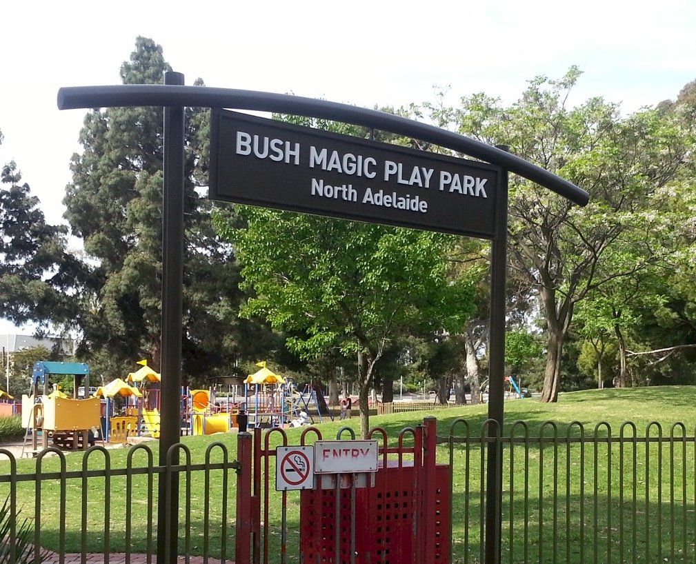
This, the Bush Magic Play Park, was designed and built in 1988.
After a design competition, landscape architect Ian Barwick was commissioned to design the play area along with manufacturer James Hubbard of Pateley-Moor Pty Ltd and contractor Richard Furniss.
Mr Barwick designed the play area intending to concentrate the play facilities into a single area which would make the playground become a ‘destination landscape in its own right’.
The play space is an important example of the contemporary generation of play parks, which set the standard for modern playgrounds that were later developed around your Park Lands.
It was also the first play space in South Australia that was specifically designed for wheelchair access.
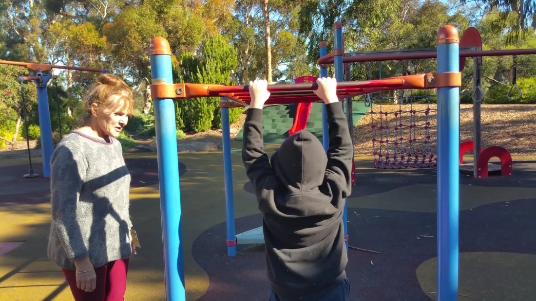
Some features of the Playground include a fully fenced play area equipped with multiple slides, swings, monkey bars, a sand play area, a pommel seesaw and a maze.
A Liberty Swing is also available for children in wheelchairs to use.
Although the Bush Magic Play Park has been around for decades, the play area remained a popular and favourite spot for many toddlers and children. Its popularity declined after the Aquatic centre was closed in 2024.
From here, exit the playground, heading east. Keep walking through the open woodland next to the construction site, and stop under two pine trees where you can see two picnic benches and a barbecue.
Turn to look back at the former Aquatic Centre demolition site.
13. Crows HQ battle
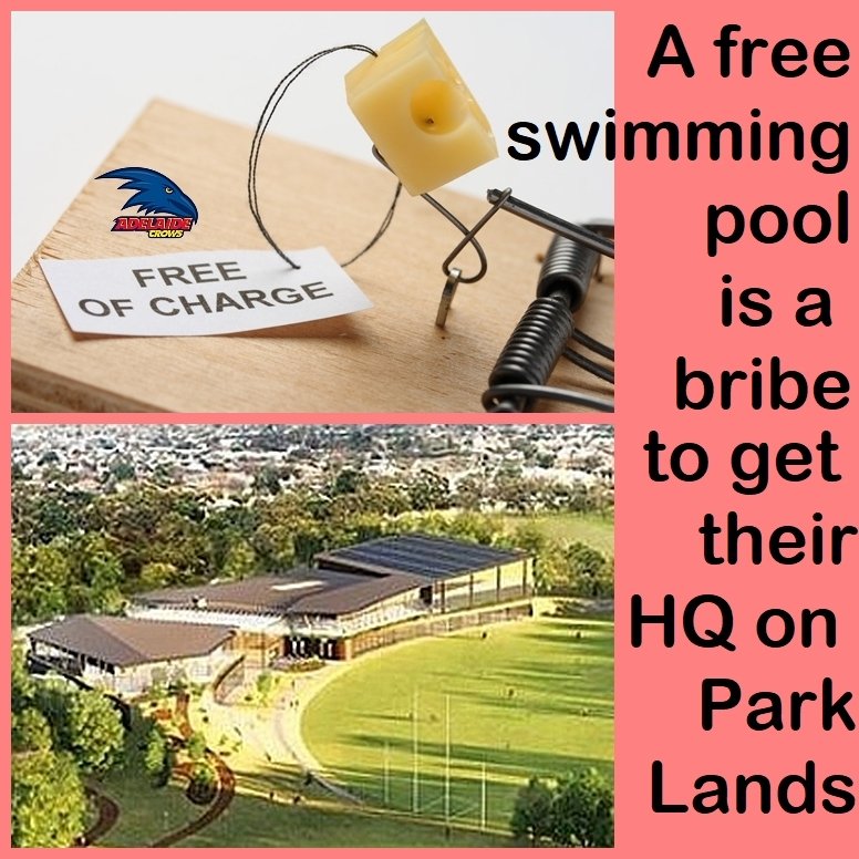
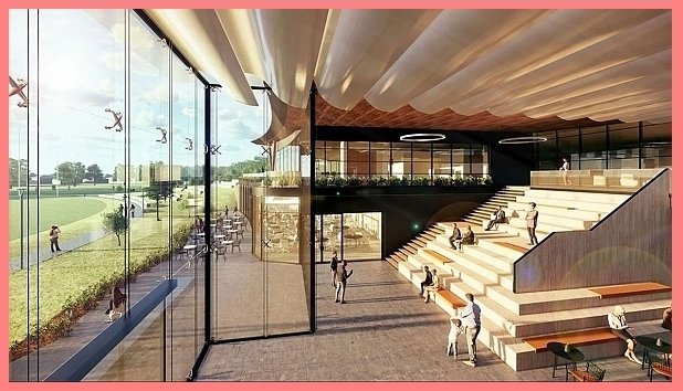
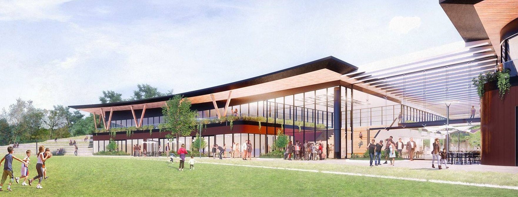
In 2019, the Adelaide Crows Football Club approached the City Council with a proposal to build their headquarters and training facility on this Park, replacing the Aquatic Centre.
The Crows’ plan included constructing a $65 million two-storey training centre, an underground car park, a new aquatic centre and transforming the oval off Barton Terrace West into what they called an ‘AFL standard’ oval.
The discussions between the Crows and the Council were initially conducted without public knowledge or input. In March 2019 the secret discussions were confirmed by the Crows, but discussions went on in private for another eight months until, on 10 December 2019, the Adelaide Football Club’s artists impressions were unveiled.
An official period of consultation followed, for three months, until March 2020. Two community rallies were held in the North Adelaide Community Centre in early 2020, attracting widespread media attention. The Adelaide Football Club did not respond to any public criticism.
Area councillor Anne Moran had described the consultation as being ‘flawed’ and ‘disingenuous’. The process failed to allow the public to express their views on the commercialisation of the Park Lands – only on the one commercial proposal.
Out of 2,979 responses received during the consultation period, 1,443 (52%) of the responses were against the Crows’ proposal.
An opinion poll, commissioned by the Adelaide Park Lands Association gave respondents four choices rather than a false dichotomy of only yes or no. When four options were presented for the Aquatic Centre, only 26% of the respondents were in support of the Crows proposal.
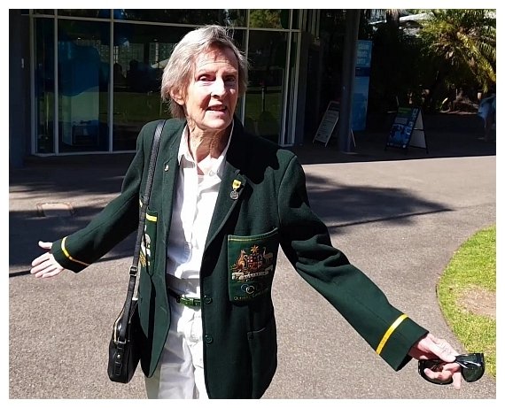
Several notable members of the public also spoke out against the Crows proposed takeover, including Denise Norton (after whom this Park is named), former South Australian Premier, Reverend Dr Lynn Arnold, former Lord Mayor and Member for Adelaide, Jane Lomax-Smith and former Crows coach, Graham Cornes.
Denise Norton herself appeared in a six-minute video about the issue and in that video, offered to stand in front of bulldozers, if necessary.
On 4 April 2020, after the emergence of the COVID pandemic, the Adelaide Football Club formally withdrew their bid. However, they continued seeking a Park Lands site and suggested alternative sites in Park 10 (where the Council has a green waste recovery centre) and in Park 25 next to the Narnungga Urban Forest.
However on 2 March 2021, the elected members of the Adelaide City Council voted unanimously to oppose any plans by the Crows to build any administrative or commercial facilities on any part of the Adelaide Park Lands.
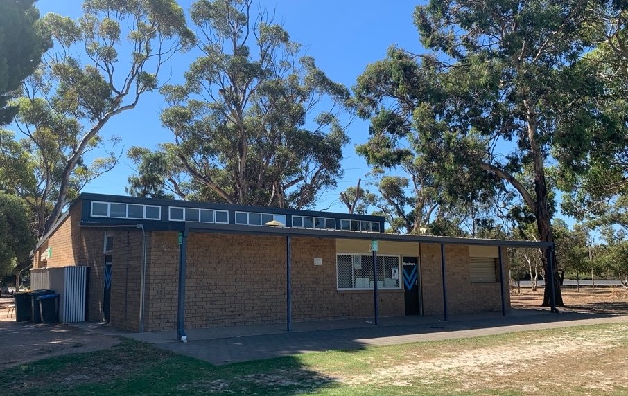
Now walk to the cream brick shed, and look over the sporting field.
14. Sports fields
When construction began on the new Aquatic Centre, in November 2023, the number of sporting fields within Park 2 was reduced from four to two. Two rectangular soccer pitches (in the south of the Park, off Barton Terrace West) were lost as the construction began.
Two other oval sports fields in the north-eastern part of the Park remain.
The most northern oval field is known as the Saint Dominics Oval. The adjacent field is the Leroy Oval.
Although the sporting ovals have been licensed by the Blackfriars Priory School, the ovals are still open for public use when unoccupied by the school.
Each of the two ovals has a cricket pitch built in the middle. The flat surface of the cricket pitch is made out of an artificial material that does not require much maintenance.
Throughout the year, these two ovals are popular with locals, with semi-regular or casual use for cricket, football and other sports especially during the weekends.
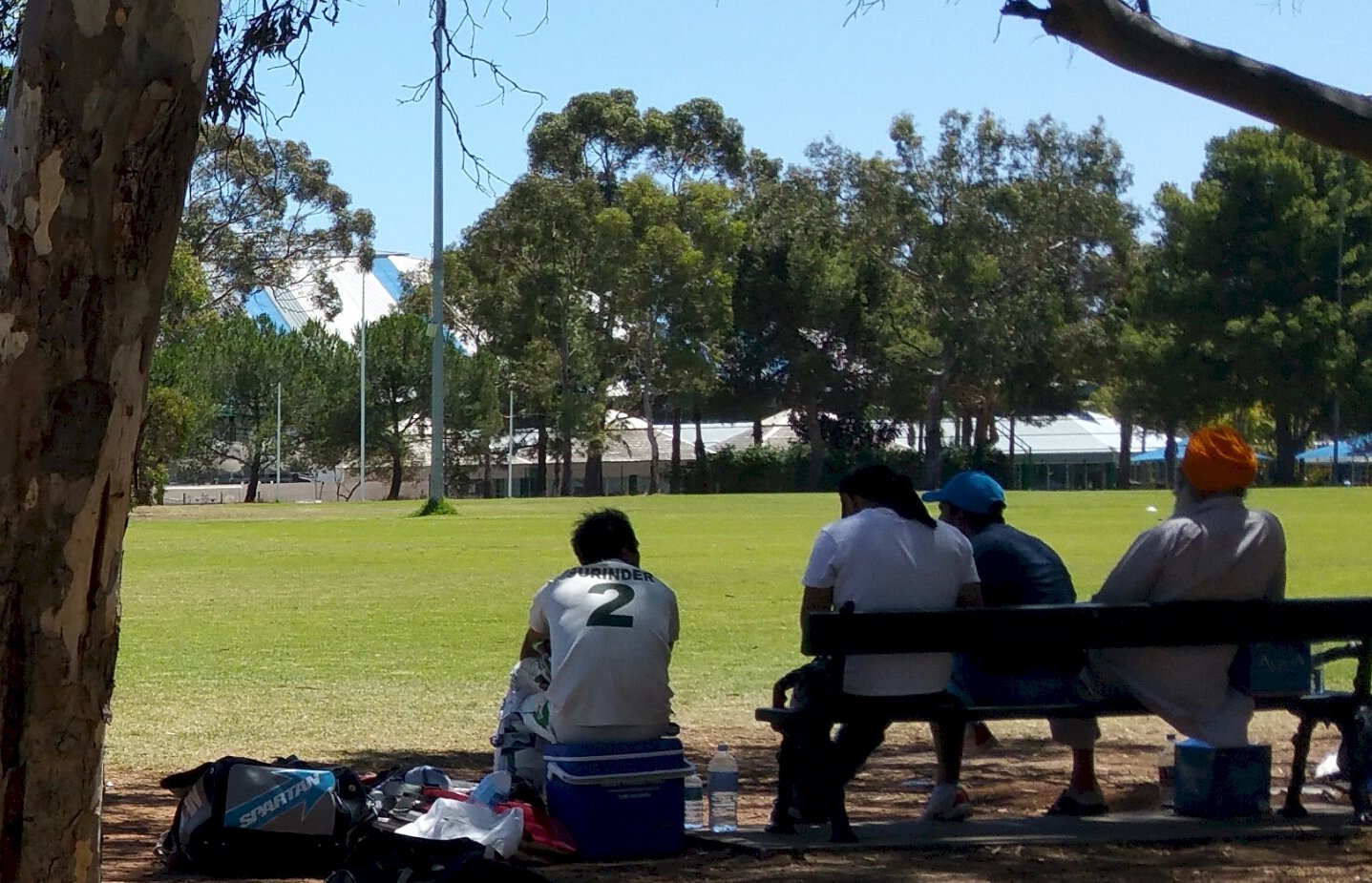
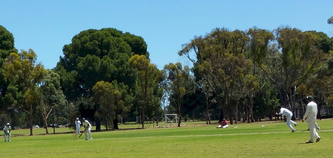
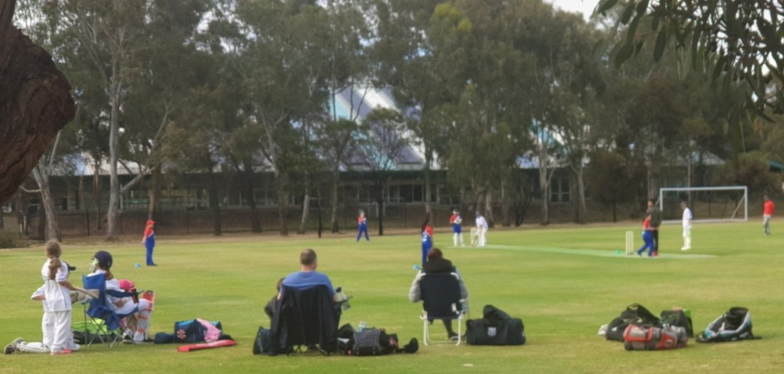
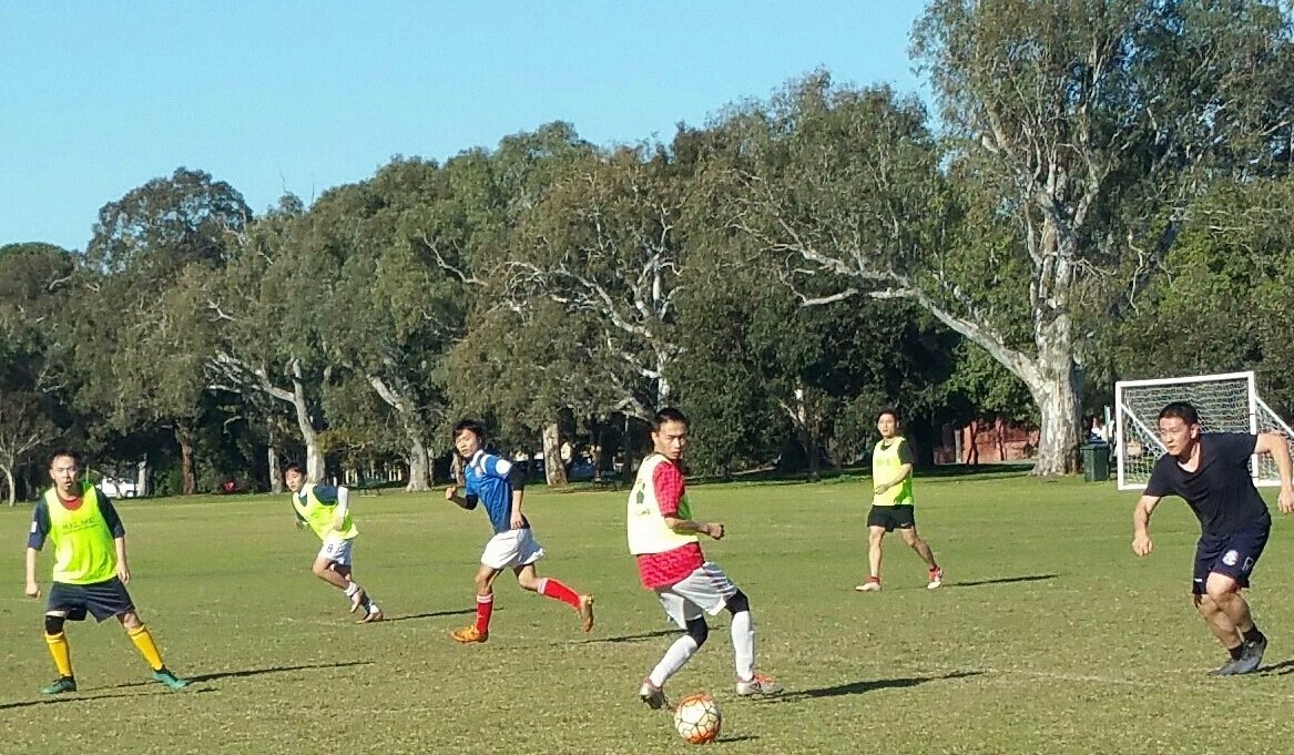
The Saint Dominics Oval is also used as a competition venue for the South Australian Cricket Association’s Premier Cricket league.
The cream brick shed is used by the Blackfriars Priory School.
Blackfriars is a private Roman Catholic school for boys that is located on Prospect Road, a few minutes walk north from this Park.
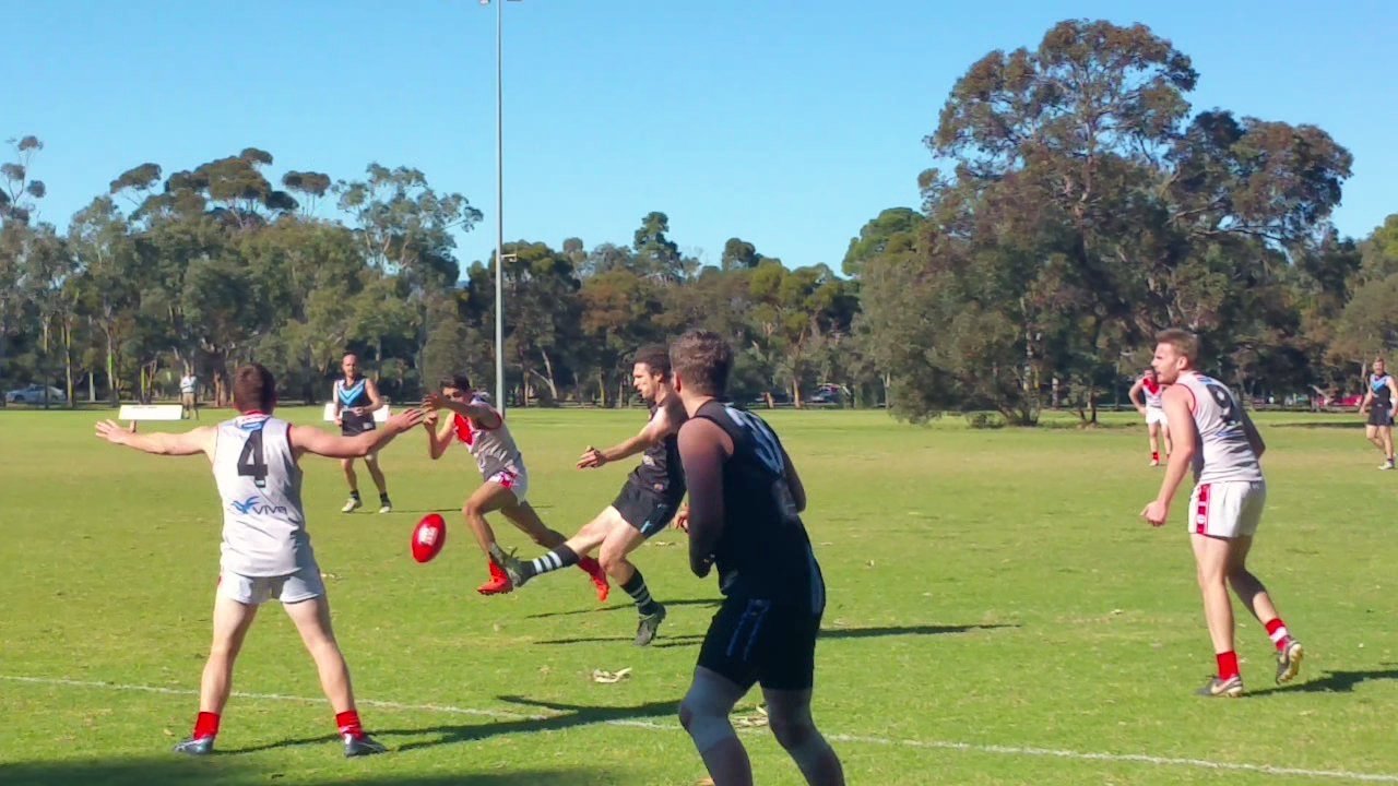
Blackfriars has licensed the use of the sporting ovals and tennis courts in Park 2, which means they have the first right of use of the sporting facilities where the students participate in several sports such as tennis, football, cricket and soccer.
This shed is on the edge of the Saint Dominics Oval, which is the one used most often by the Blackfriars school.
A home game for Blackfriars Priory College on St Dominic’s oval. Pic: Shane Sody
In 2017, the sporting licence and lease agreement between the Council and Blackfriars had expired. The Council asked for expressions of interest for any other group or school that might want to licence the facilities in this Park.
The Council received two expressions of interest submissions but decided, in 2018, to renew the licence agreement with Blackfriars.
From this point, walk around the northern side of St Dominic’s Oval, and stop just past the goalposts.
15. Trees on the northern flank
The main feature trees on this northern flank of Park 2 are six large Sugar Gums (Eucalyptus cladocalyx).
There are also several specimens of Norfolk Island Hibiscus trees (Lagunaria patersonia) some Red Ironbarks (Eucalyptus sideroxylon) and Canary Island pine trees (Pinus canariensis) which were probably planted between 1920-1930, and some South Australian blue gum (Eucalyptus leucoxylon).
During late spring to mid-summer, the Norfolk Island Hibiscus produces masses of pale pink coloured star-shaped Hibiscus flowers.
Norfolk Island hibiscus trees in bloom, in Park 2
Also along the northern edge of the Park, just east of the sports field goal posts, are several specimens of Round-leaf moort (Eucalyptus platypus) that feature large yellow blossoms over the warmer months of the year. .
A South Australian blue gum (Eucalyptus leucoxylon) on the northern flank of Park 2.
From here, walk eastwards to Prospect Road tennis courts and exercise station.
16. Tennis Courts, exercise facilities
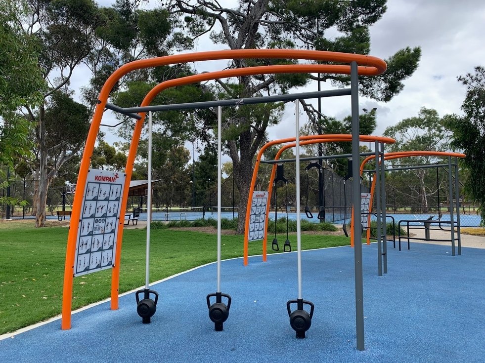
In 2020, the Adelaide City Council upgraded these community facilities, and built a new shared walking-cycling path alongside Prospect Road and a new fitness hub with outdoor exercise equipment.
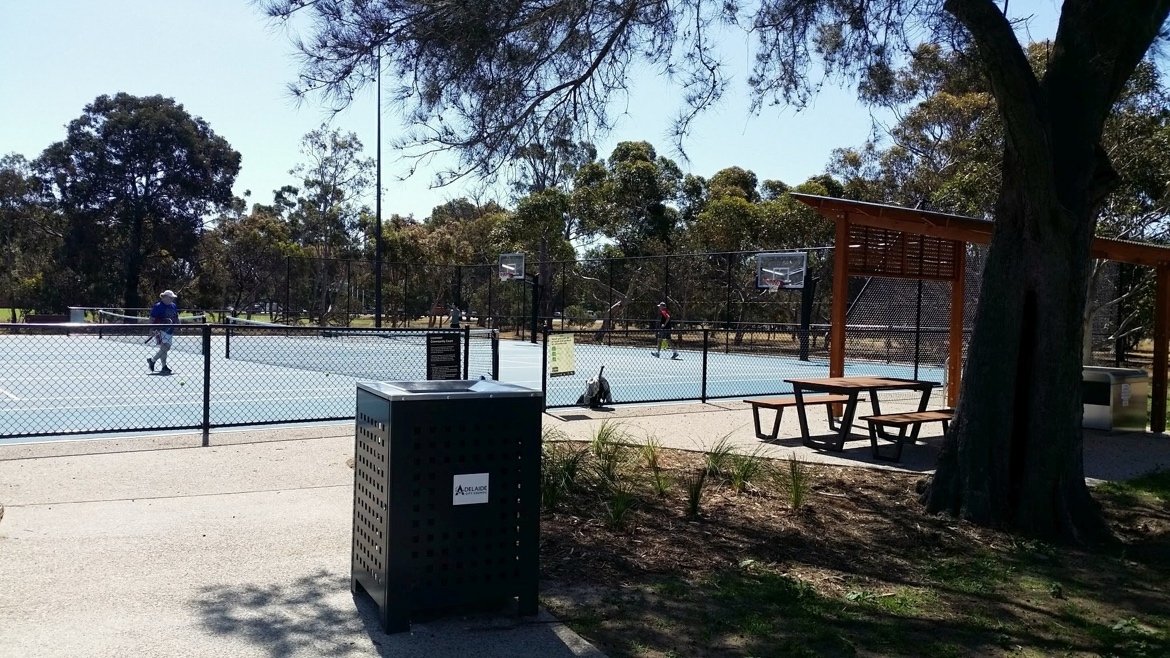
The four tennis courts received a new acrylic blue playing surface, new fencing and new tennis nets. Four basketball rings were also added to the previously-existing tennis space.
Just outside the tennis court are sheltered BBQ facilities for community use and gatherings.
The tennis courts have been licensed by the Blackfriars Priory School.
However that just means that the School has first priority for the use of the courts.
When they are not used by the school, they are still accessible for public use until 11pm every day.
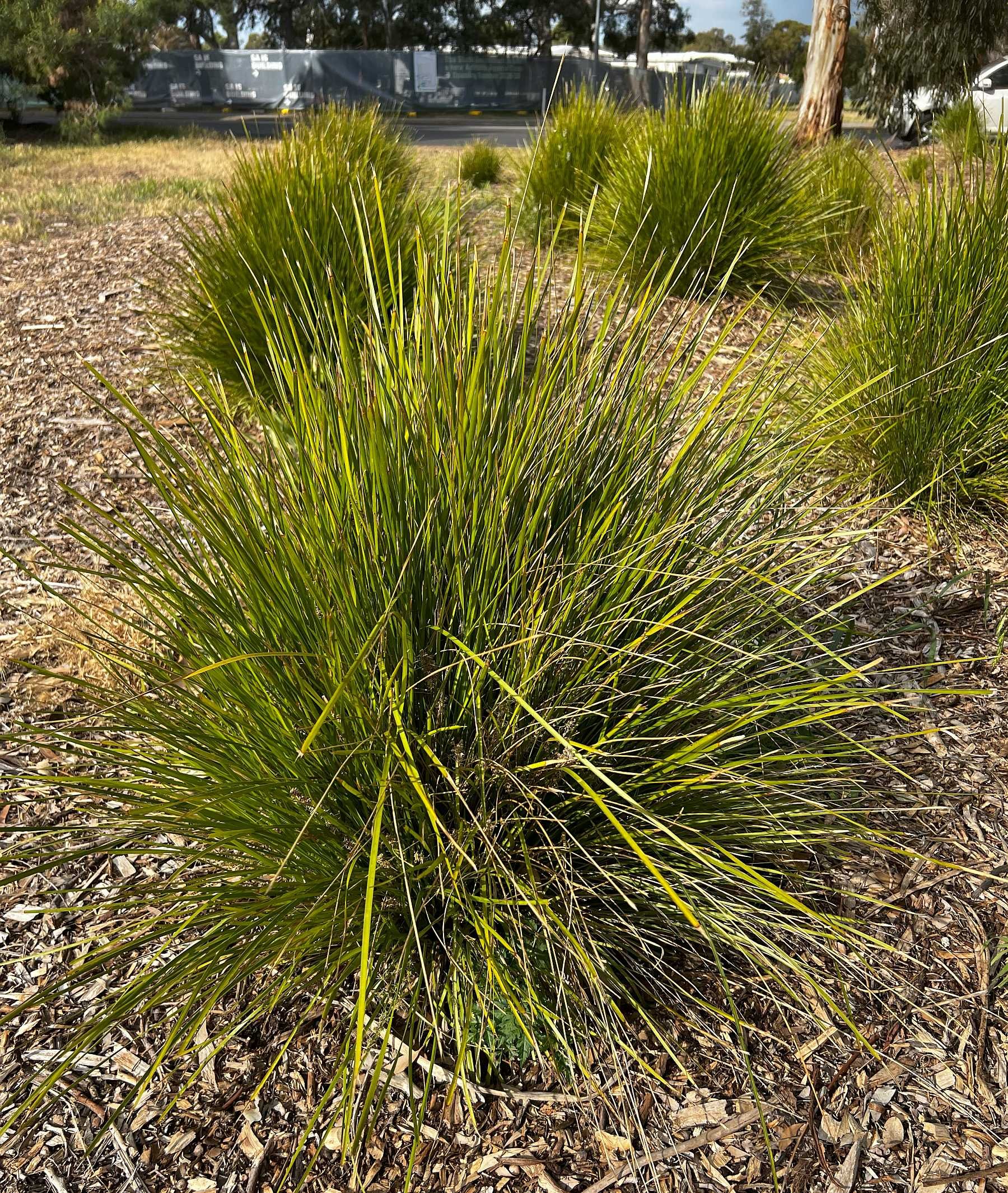
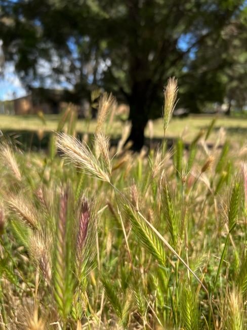
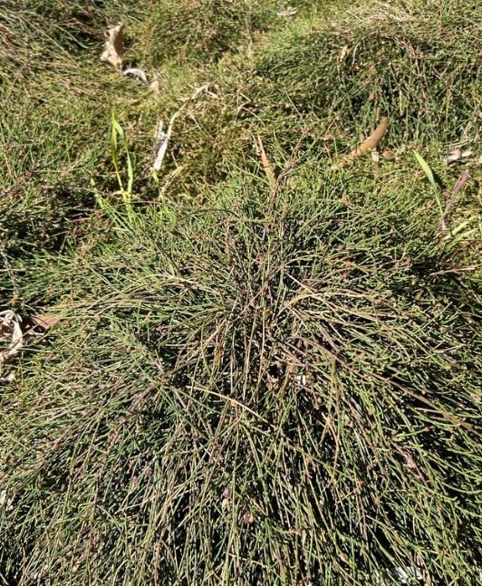
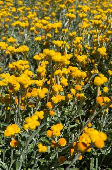
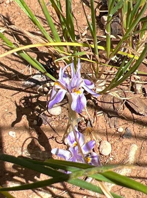
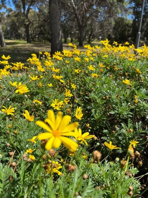
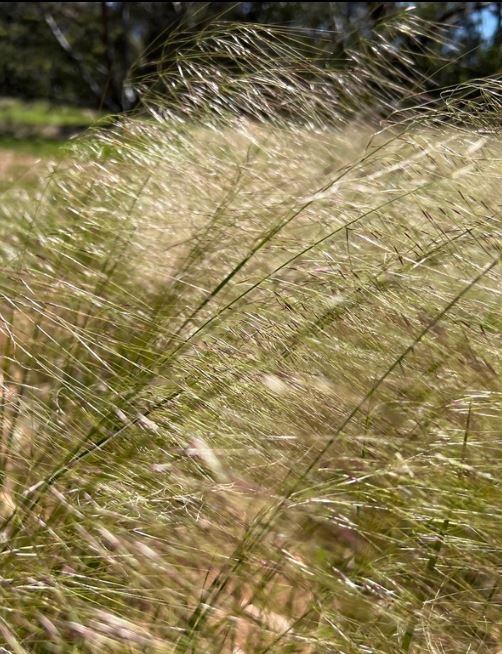
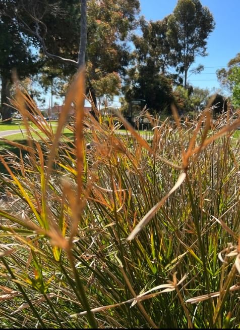
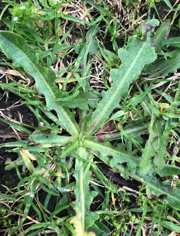
On the northern side of these facilities, a number of native grasses and flowers have been planted. The pics below are recorded in the iNaturalist website and app. You can contribute your own biodiversity observations (in any location) to the iNaturalist citizen science community.
From here, walk southwards along the edge of Prospect Road to the starting point on the corner of Barton Terrace West.
17. Back to SE corner
Walking back to the starting point of this Trail Guide, at the corner of Prospect Road and Barton Terrace West, notice the young Jacaranda trees planted along the edge of Prospect Road. If you are fortunate enough to be visiting this Trail in November you will see them in bloom, covered in mauve.
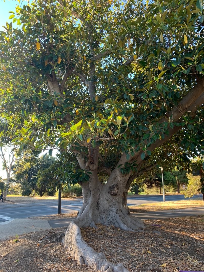
As you near the end of the Trail, you will see a magnificent specimen of a Port Jackson Fig (Ficus rubiginosa) believed to be the largest such specimen anywhere in the Adelaide Park Lands.
To fully appreciate its age and size, walk under its wide-spreading branches, and stand beneath its canopy.
Its age is unknown but it was likely planted in the early 1900s. A City Council report produced in 2007 classified this tree as of “high” cultural significance.
A little further south, almost at the corner, is another huge tree: this one a River Red Gum (Eucalyptus camaldulensis) which would appear to be of a similar age.
Optional: download and print a tri-fold leaflet, i.e. a double-sided single A4 page with a brief summary of this Trail Guide: (PDF, 1.7 Mb).
All of our Trail Guides and Guided Walks are on the traditional lands of the Kaurna people. The Adelaide Park Lands Association acknowledges and pays respect to the past, present and future traditional custodians and elders of these lands.
See our other Trail Guides >>>>
Photo Credits:
State Library of South Australia: Queens College 1928 SLSA B-4795, SLSA B-5031, Caledonian Hotel c1913 B-10294
Adelaide City Council Archives: Aquatic Centre 1972


