

Take the Trail
Start at the Bonython Park kiosk (aka ‘Cafe Bonython’)
This Trail is on the traditional land of the Kaurna people.

1. Introduction, at kiosk
2. Adventure Playspace
3. Billabong and terraced garden
4. The Magic Forest
5. Roma Mitchell Garden
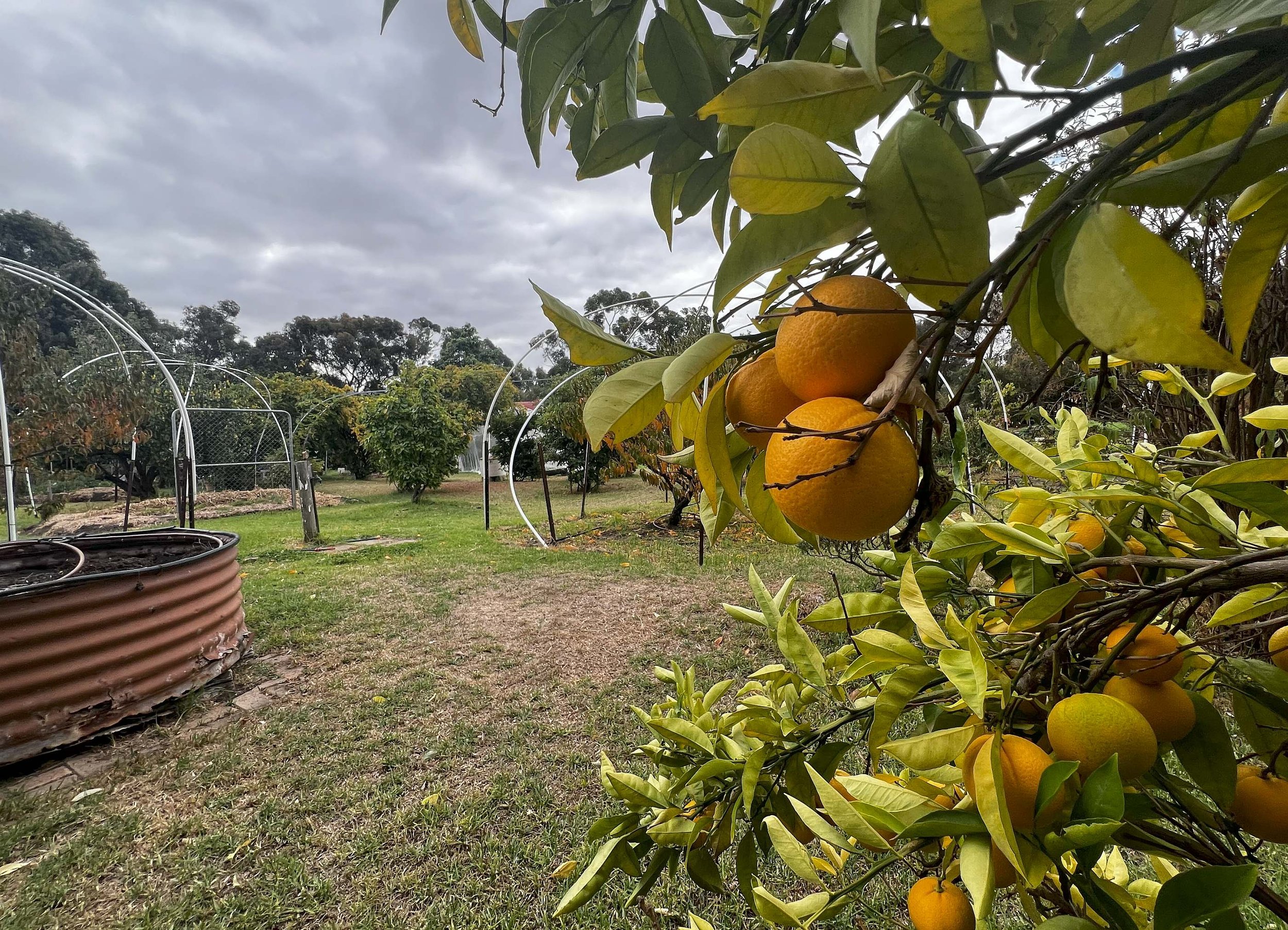
6. Olive Grove
7. Former Police barracks
8. New Women’s and Children’s Hospital
9. ‘Gift of Life’ garden
10. Entrance art sculpture
11. Proposed beach volleyball site
12. Model Boat Pond
13. Community open spaces
14. Circus and events site
15. Kaurna significance
16. Landscaping in the 1960s
17. Park Lands Trail
18. Return to kiosk - a slaughterhouse site
Start this trail at the Bonython Park kiosk (aka “Cafe Bonython” which is location #1 on the map above). There are 18 stops on this Trail and it will take a little under two hours to complete. Walking instructions are designated by bold type at the end of each of the 18 stop descriptions.
Optional: download and print a tri-fold leaflet, i.e. a double-sided single A4 page, with a brief summary of this Trail Guide: (PDF, 1.7 Mb)

1. Introduction: at kiosk
In most other parts of the Park Lands, the Park name corresponds with a Park number, and the number has been consistent since the 1890s or earlier. This Park is different.
Although it was marked as Park Lands in Colonel Light’s map of 1837, it took more than 100 years before the people of Adelaide started treating it as a Park.
It was marked on 19th century maps as “Section 6027” but the Park number “27” came into use only in the 1960s. From 1837 until the late 1950s this area was used and abused for many purposes, and rarely resembled a park.
It was only in the late 1950s that a determined effort was made to turn it into a Park, before finally gaining its current name of Bonython Park in the 1960s. Prior to this it was known as “Hemsley’s Paddock” after the Clerk of the Sheep and Cattle Market that operated in this area.
Bonython Park, or Tulya Wardli, is only one part of Park 27, an area that includes a biomedical precinct, railways, the site of the former Police Barracks (1917-2024), the historic Old Adelaide Gaol, and a car park. This trail is centred on the area known as Bonython Park/Tulya Wardli, which is about 17 hectares.
Until 2024, there was an adjacent Kate Cocks Park within Park 27, (marked in yellow below) but that small Park was effectively destroyed by construction works for a new Women’s and Children’s Hospital.

The various parts of Park 27, before construction began in 2024 on a new Women’s & Children’s Hospital, effectively destroying Kate Cocks Park.
The Bonython Park Kiosk overlooks the Torrens River and Linear Park Trail, and is intended to service the adjacent children’s playspace.
The kiosk was closed for more than three years from January 2018, while the City Council searched for a new lessee. Cafe Bonython opened in April 2021. The proprietor is Carolyn Walker, and she hopes you’ll pop in for a coffee and one of her famous cakes!
From this point, walk along the path next to the adventure playspace, and stop where you can get a good view of how popular it is!

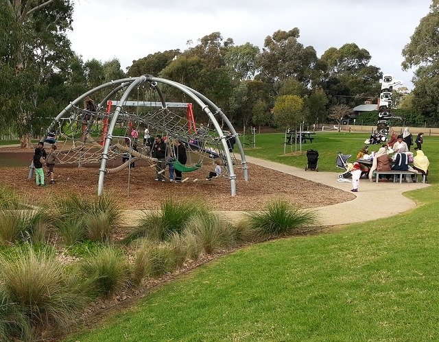
2. Adventure Playspace
.
This “adventure playspace”, built in 2012, boasts a 25-metre flying fox, wheelchair accessible merry-go-round, giant mouse wheel, slippery dips, and water play.
Each child has a chance to become an archaeologist and dig for bones in the sand pit.
The huge spider web climbing net also provides opportunities for adventure.
There is plenty of shade, and barbecue facilities and picnic tables nearby.

From this point, walk around the corner on the path and drop down to the lower level pathway closer to the river.

3. Billabong & terraced garden
Just down the hill on the northern side of the playground is the River Torrens /Karrwirra Pari. If you take a seat anywhere in this area, it will only take a couple of minutes for hungry ducks to approach looking for a snack.
You are also likely to see coots, dusky moorhens, swamphens, swans, ibis, magpies, cormorants, and sometimes also pelicans here, or close by.
Historical evidence suggests this area was a billabong used as a fishing spot for the Kaurna people prior to European settlement.
Following the arrival of European settlers from the late 1830s to 1914 it was used as a watering place and cattle grazing agistment area, together with waste refuse and offal dumping.

Landscaping works in 1960 helped re-create the billabong with terracing on the banks of the Torrens. Today you will still find keen fishermen here casting a line.
The rockery garden created in the mid 1960s, in conjunction with the Bonython Park renovations, consists of an embankment organically sculptured with boulders.

This is a unique and beautiful part of the Park and you can view it best from down at the water’s edge.
The Garden has two concrete staircases and a lookout arc.
It’s extensively planted with a mixture of River Red Gums, Oriental Agapanthus, Grevillea, Italian Cypress, Pigface, Kurrajong, Lavender, Cape Plumbago and Silver Wormwood.
From this point, retrace your steps back up the curved inclined path, to the path junction.

4. The Magic Forest
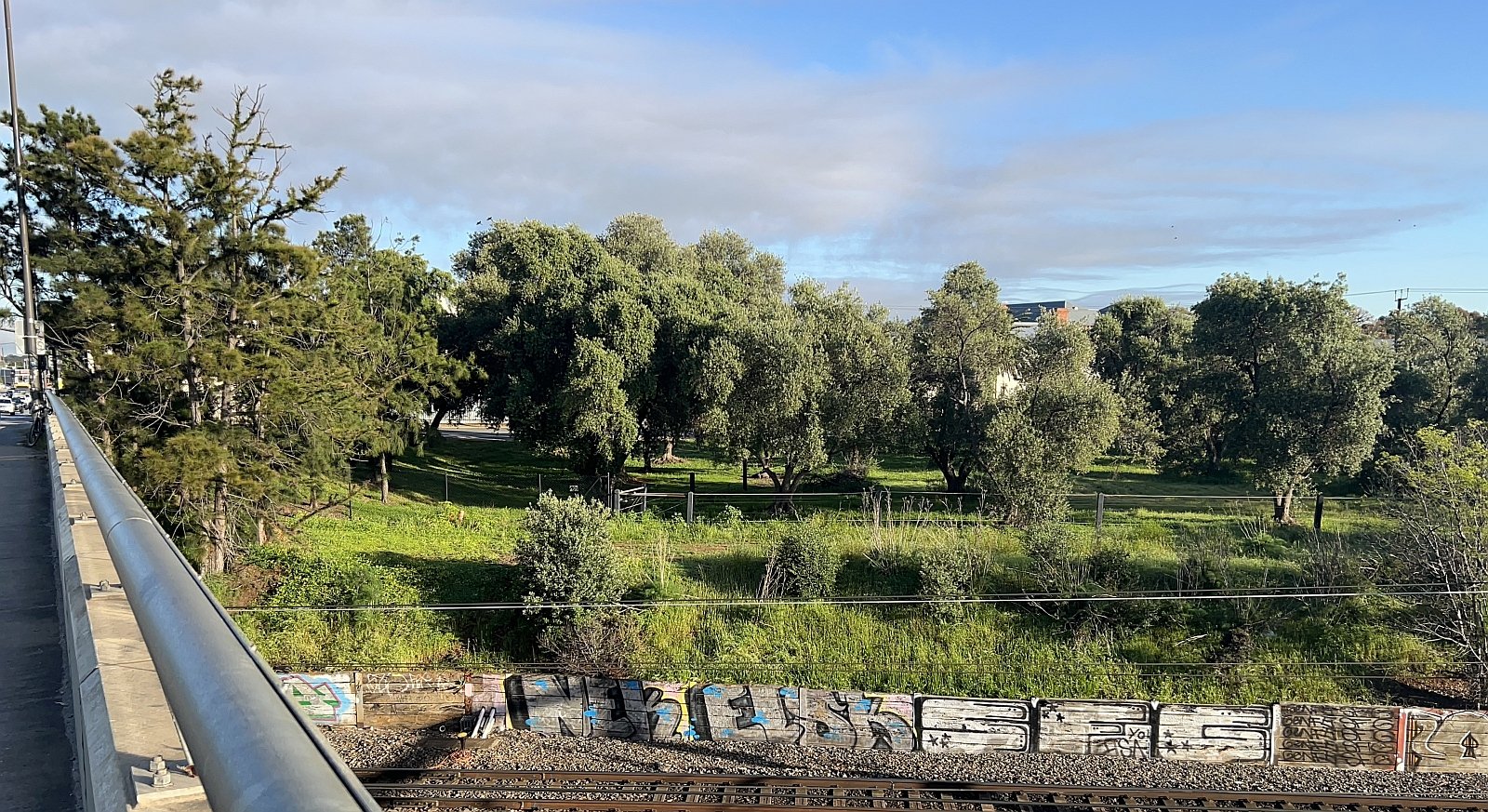
Just to the east of the Bonython Park Adventure Playspace, across the bitumen Park Lands Trail, is ‘The Magic Forest’.
Labelled “a place to dream your dreams”, the mixed eucalyptus planted grove was a 1997 initiative of the Children’s Peaceful Environment Foundation, in conjunction with the Adelaide City Council.
Within the Magic Forest is a native bee “hotel” built in 2018 to provide nesting places for different species of native bees. It’s part of a scheme to attract native bees to the River Torrens Linear Park.
Around the world, bee species are in decline. “The Adelaide Native Bee Project” started in 2017 to attract native bees to the River Torrens Linear Park and the Park Lands.

Magic Forest Bee BnB
Other, similar bee hotels within the Adelaide Park Lands are in:
• G.S. Kingston Park / Wirrarninthi (Park 23) (just off Catholic Cemetery Rd); and
• a biodiversity re-vegetation site on the river’s edge in Mistletoe Park / Tainmuntilla (Park 11).
In Australia there are over 2,000 species of native bees. They don’t swarm – they’re solitary. They are small and easy to miss, and not aggressive. They aren’t relevant to the honey industry but they do pollinate native vegetation, and they do it much more effectively than honey bees. The City of Adelaide has also planted a lot of nectar plants around this Bee Hotel. (There’s no hotel without a restaurant!)
In 2018, the City of Adelaide produced this 3-minute video on the Native Bee Project, featuring Gardening Australia presenter, Sophie Thompson.

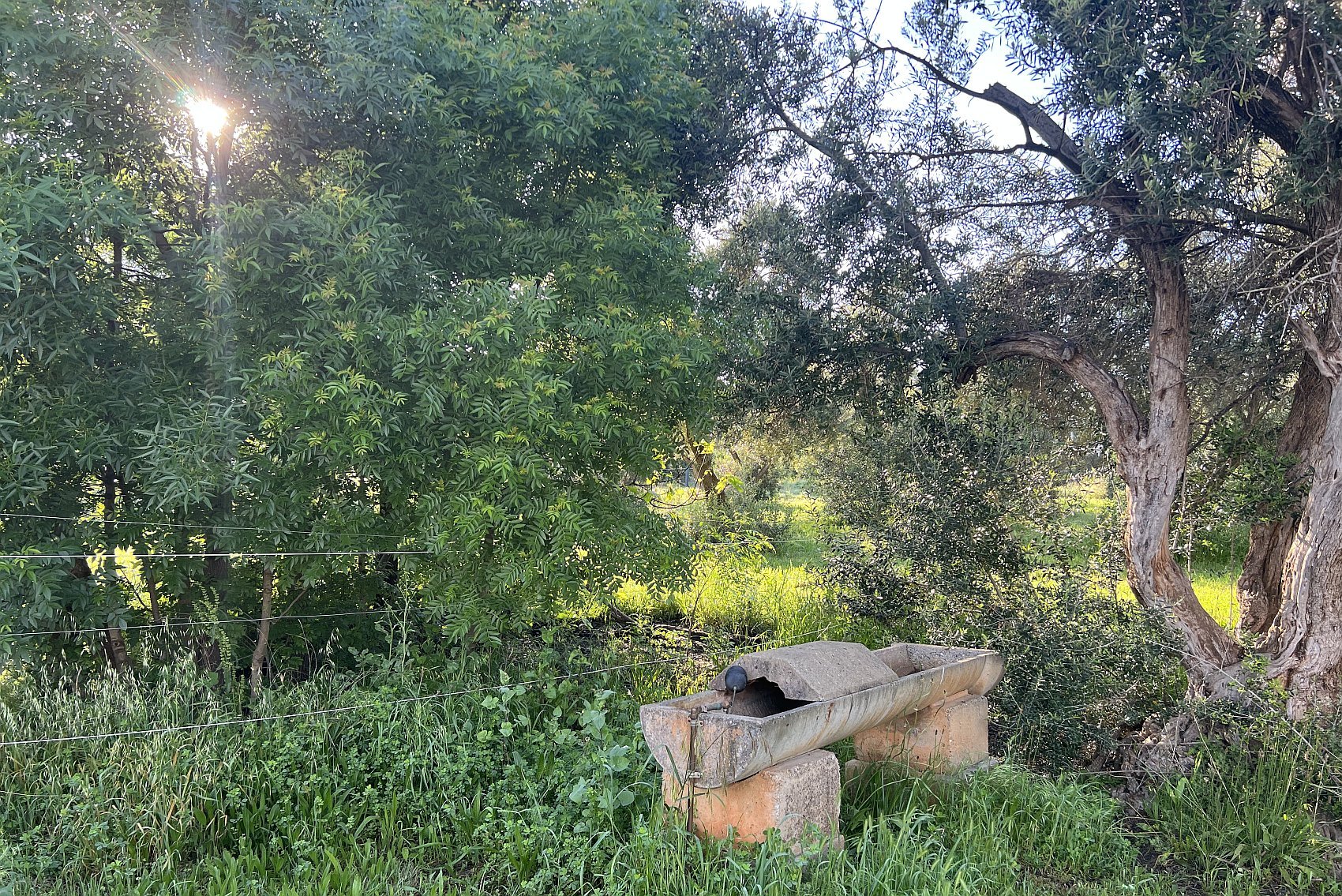
5. Roma Mitchell Garden
Just to the right of the native bee hotel there is a high fence, which marks the rear or “back yard” of the Old Adelaide Gaol, which was closed in 1988.
Behind the fence you can see a sign: “Roma Mitchell Garden.” Dame Roma Mitchell was a former Governor of South Australia, and Australia’s first female Supreme Court Judge.
Although it's a full hectare in size (10,000 square metres, or two-and-a-half acres) few people know that this garden exists, because it's hidden from sight behind the stone walls of the old Adelaide Gaol, a railway line, and high cyclone wire fencing, with a locked gate.

A rose garden was started on this site, back in 1932 by female prisoners at the Old Adelaide Gaol.
Male prisoners took over caring for the garden in 1969.
The last prisoners were moved out in 1988, and the Old Adelaide Gaol closed. It then became (and remains) a heritage tourist site in Park 27 of your Adelaide Park Lands. https://adelaidegaol.org.au/
Since the 1990s the garden has been used to grow food for Adelaide charities. Both Dame Roma Mitchell, and the Catholic Order of Malta, which included Adelaide’s world-famous singing nun, Sister Janet Mead, helped to get it established.
However the Church does not run the garden. That task is carried out by the Adelaide Day Centre for Homeless Persons, which helps and encourages homeless and disabled people to work here.
The garden includes fruit and nut trees, vegetable patches, chicken sheds, bee hives, flower beds and hedges. In the past, there’s been a resident goat or two.
A caretaker lives on site, in a heritage-listed stone cottage, that was built in 1883 as a residence for the keeper of the adjacent (long-defunct) stone-walled "powder magazine" (explosives store).
Until April 2024, there was a second house within the garden, a 1960s bungalow, housing a second caretaker. That bungalow was destroyed in an early morning fire:
The destroyed bungalow was replaced in 2025 with a prefabricated steel cabin.
The Adelaide Day Centre for Homeless Persons has a long-term lease to use the site, for a rent of only $1 per year.
Read more about the Roma Mitchell Garden in these three articles:
From here, head west on a bitumen path, past a Council works depot to see what remains of an historic olive grove.

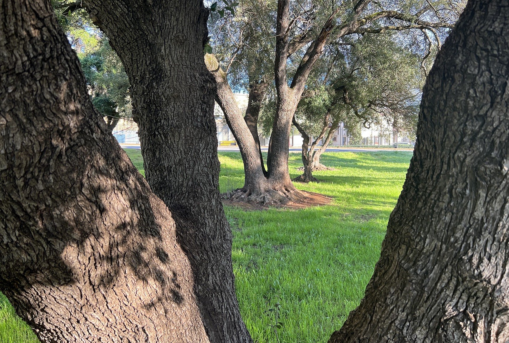
6. Olive Grove
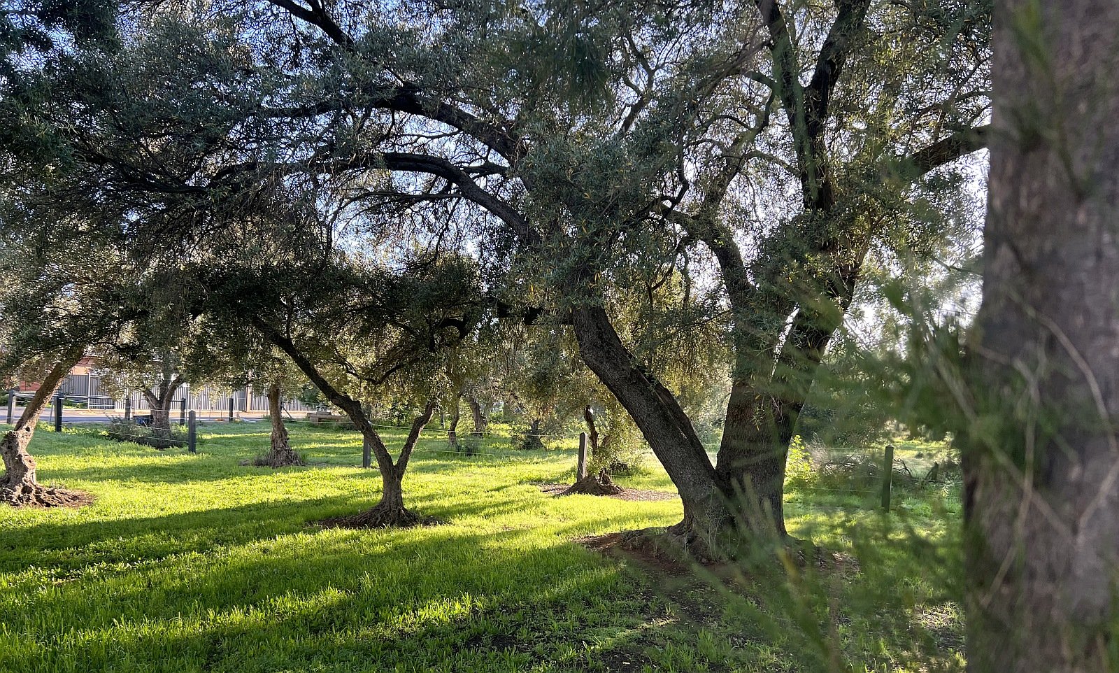
On your left is a fenced off area containing a small remnant of what was the second olive plantation in your Adelaide Park Lands.
The grove was established in 1862 by Sheriff William Boothby, and was regularly maintained and harvested by Adelaide Gaol prisoners until the City Council eventually took over the task of maintaining the grove.
Progressively, the plantations were felled to make way for railway line and yard expansion, together with the development of the Thebarton Police Barracks in the early 20th century, and most recently (in 2024) for construction of a new Women’s and Children’s hospital and car park. However a remnant few of the historic olive trees have been retained.
This was the second area of the Park Lands that was planted with olives following the establishment of plantations in Kuntingga (Park 7) and Parnguttilla (Park 8) (“The Olive Groves”) between Gilberton and lower North Adelaide.
Until 2024, you would have been able to see, roaming around between the olive trees, some light grey horses.
For more than 50 years, (between the early 1970s and 2024) this area was the home of the SA Police ‘Mounted Operations Unit’ and their horses known as the police ‘greys’.
At various times, there were up to 24 horses here. Others were kept at a police site near Echunga in the Adelaide Hills.
Although the horses were a popular sight here, the way that police managed the herd after 2010, confining them to a relatively small area, caused two problems for the historic olive trees. The horses began compacting the soil more intensely, damaging the tree roots, and they began nibbling away at the cambium layer of the tree trunks.
European olive trees can live for thousands of years, so removing the horses was expected to improve the chances of these trees surviving.
However the trees you can see here are only the few survivors of a drastic cull that took place in May 2024. Hundreds of the 1860s olives were cut down, nearby, to make way for a new Womens’ and Children’s Hospital.
From this point, keep walking along the bitumen footpath until you reach the sandstone toilet block next to the car parking area.

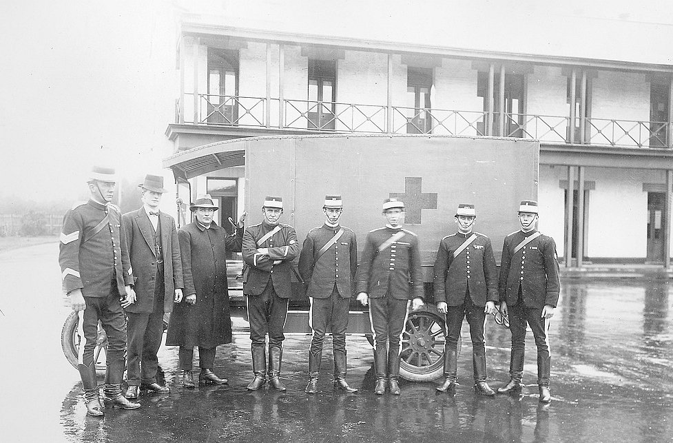
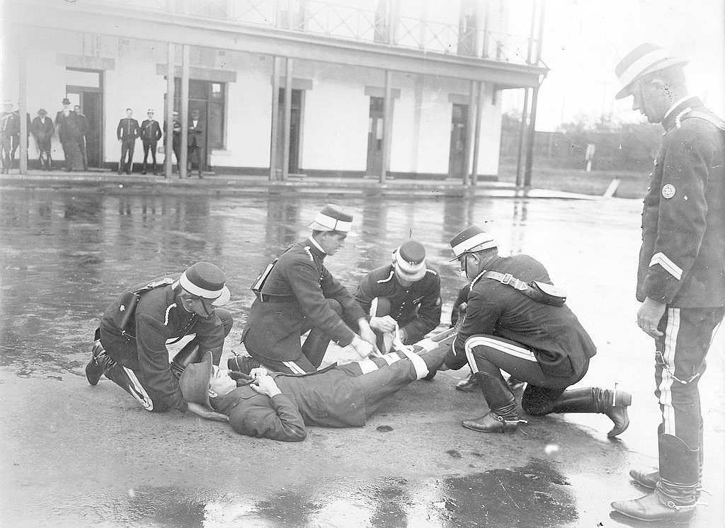
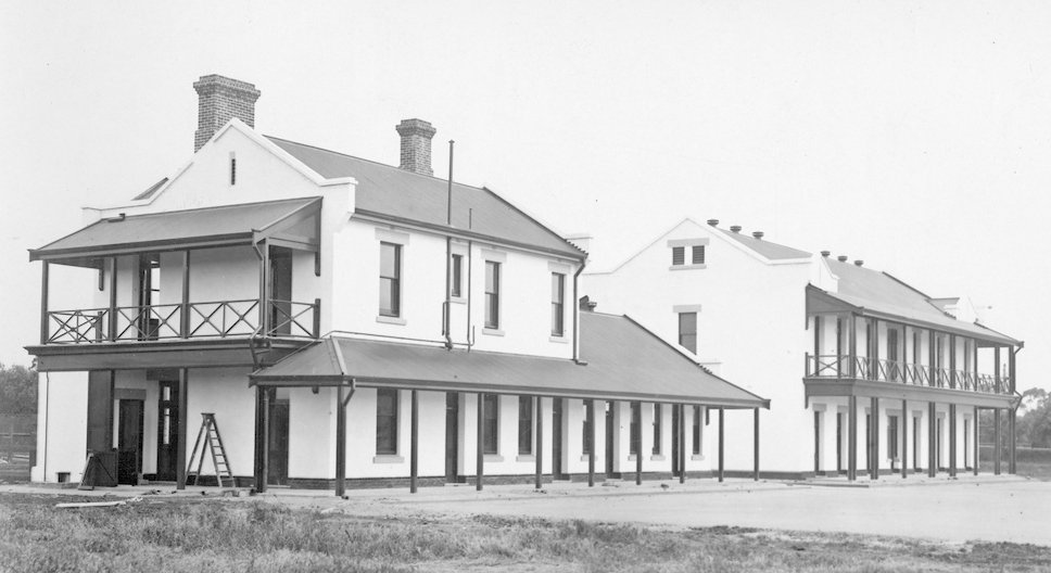
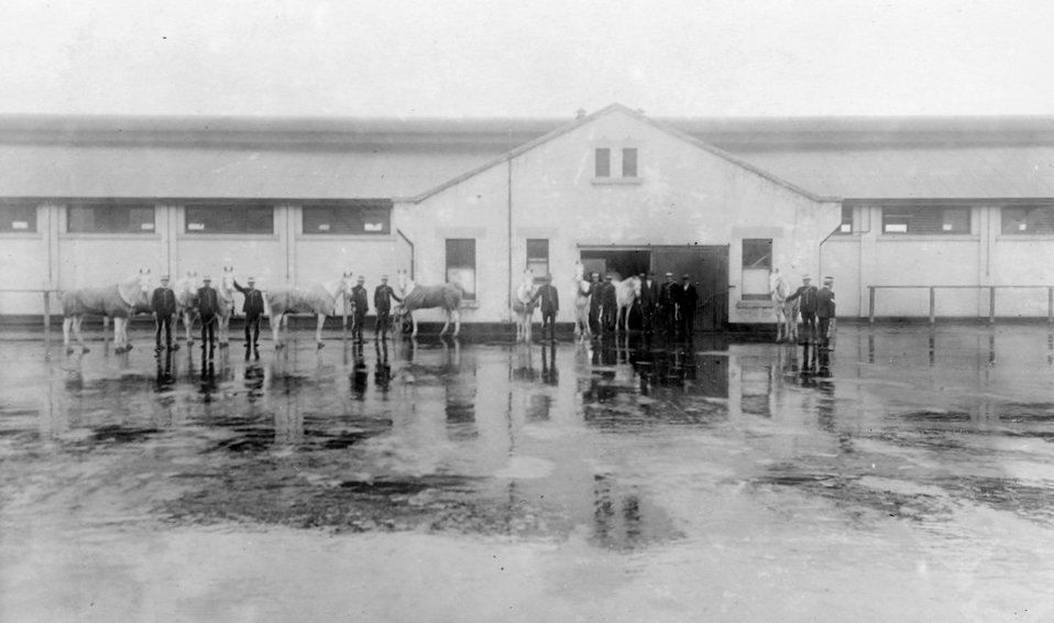
7. Former police barracks
The Kaurna name for Bonython Park is Tulya Wardli, meaning “Soldier Barracks”.
What used to be known as the “Thebarton Police Barracks” were established in this Park in 1917. The barracks covered two hectares of Park 27, and the fenced enclosure for police horses used to occupy another four hectares so that the entire police presence here was spread over six hectares of the Park.
However all police presence was removed in 2024 to make way for demolition of the barracks and the construction of a new Womens’ and Children’s Hospital.
Before it was vacated, the police barracks were used by about 250 employees for mounted operations, dog training, road safety, police band practice, security services, traffic camera and armoury sections.
The Police Historical Society also used three buildings at the barracks to store records and exhibit collections of police memorabilia.

The former SA Police Historical Society Museum
The barracks had a kitchen, administration quarters, dormitory, stables, chaff mill, farriery, saddlery, and quarantine shed.
Ten buildings on this site were State Heritage-listed. However that listing did not protect them, when State Parliament passed a new law, in 2022, authorising their destruction,.
Starting in early 2024, all police operations were gradually moved out, so that the barracks (like most of the heritage olive trees) could be demolished to make way for a new Women’s and Children’s Hospital.
From here, walk south-west towards Port Road, along the fence-line, and stop where you can get a view of the new Women’s and Children’s Hospital construction site.
>

8. New Women’s & Children’s Hospital
When announcing the State Government’s chosen site for the proposed new Women’s and Children’s hospital, in September 2022, Premier Peter Malinauskas claimed that State MPs had to make a binary choice. He urged Members of Parliament to vote YES to a hospital, and NO to built heritage; as well as NO to retaining this part of your Park Lands.
But he simply overlooked the best option: having both.
In November 2022, State Parliament passed legislation which allowed a $3 billion new Women’s and Children’s Hospital to replace the Thebarton Police barracks and much of Kate Cocks Park in Park 27 of your Adelaide Park Lands.

The view in 2022, before demolition and construction commenced.
Before the Parliamentary vote was taken, the Premier tried to portray this as a simple yes-no question. In effect, he asked politicians and the public to decide between a great new hospital, OR protection of built heritage and Park Lands heritage.
However this was a false dichotomy, a misleading binary choice. There was no need to choose between the two. It showed a lack of imagination to suggest that such a choice was required.
The New Women’s and Children’s Hospital Act 2022 was rushed through Parliament in a few days. Debate in the Legislative Council took only three hours. There was no opportunity for heritage supporters or Park Lands supporters to lobby MPs to push for a better, brownfield site.

A Government artist’s impression of the new hospital (left) and a new eight-storey car park (centre) next to the railway line (right.)
The site of the car park was cleared of hundreds of century-old trees (a forest of she-oaks and olives alongside the railway lines) in May 2024. See the photos below.
The Premier dismissed the suggestion advanced by the Adelaide Park Lands Association and others, that the ideal site for a new Women’s and Children’s Hospital would have been across North Terrace incorporating the old Newmarket Hotel and potentially other adjacent land. Mr Malinauskas claimed that the site on the corner of North Terrace and West Terrace would have been difficult for ambulance access - apparently unwilling to consider any engineering solution.
The site of the Newmarket Hotel opposite the RAH had previously been assessed as suitable for two buildings of up to 32 storeys each, (even while protecting the old hotel building) so that there would have been no problem finding space for sufficient hospital facilities. That site would have allowed the RAH and the WCH to have been linked by an air bridge across North Terrace.
One of the reasons given for choosing this Park Lands site was because the Government wanted to leave open the option of future hospital expansion, further into your Park Lands.

A still image from a State Government video, noting that its plans for a new Womens’ and Children’s Hospital on the western side of the railway line “Preserves future expansion space”. The “expansion space” is the garden immediately west of the Royal Adelaide Hospital, where the previous Liberal State Government wanted to construct a new Womens’ and Children’s Hospital. See below.
From here, walk westwards, across to a small rose garden.

9. ‘Gift of Life’ Garden
Next to the former Police barracks (on the western side of what is now the hospital construction site) there was a mock roadway, specially designed for children to ride their bikes in a safe environment and learn about road safety. The former Police Road Safety Centre included real traffic lights, give way signs and roundabouts on this location from 2013 to 2024.

The Centre used to provide road safety education for schools and community groups. However it was de-commissioned from May 2024 to make way for the new Women’s and Children’s Hospital. It was relocated to a new site on Military Road at West Beach.
Nearby, there is a collection of rose bushes called the “Gift of Life Garden”. These rose beds were established as an expression of gratitude, and to pay tribute to the many organ donors and their families for making new life possible.
It was dedicated in 2001, by the then South Australian Governor, His Excellency Sir Eric Neal.

From this point, walk across the grass onto the paved path, and stop just before the traffic lights on Port Road.

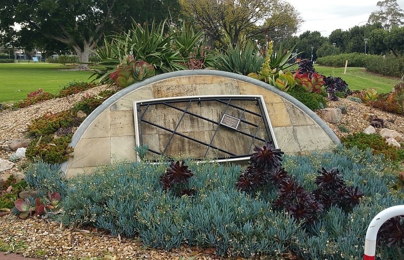
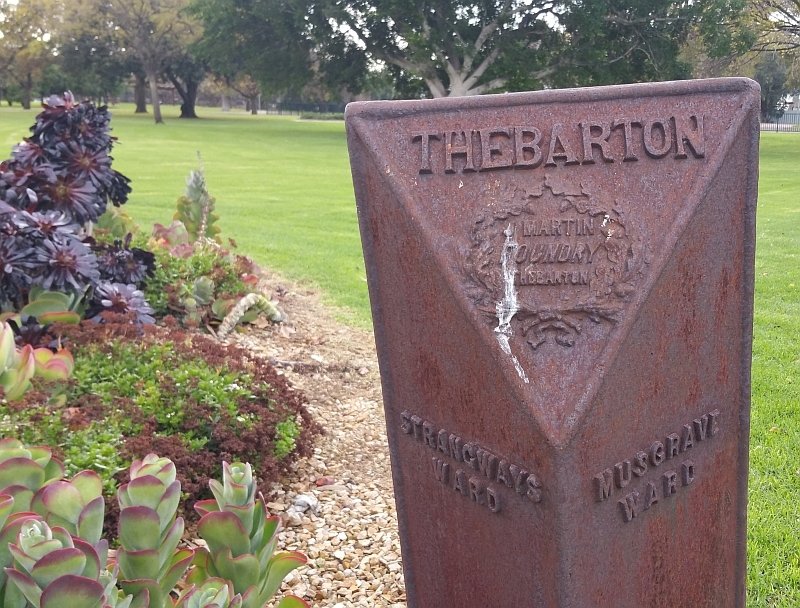
10. Entrance Art Sculpture
This pathway is one of the formal entrances to Bonython Park / Tulya Wardli (Park 27).
Here, you will find two art works, one on either side of the path. They were erected in 1997 as part of road reconstruction and widening works for Port Road.
Also here you will see a cast iron marker denoting the edge of the Strangways and Musgrave wards in the original Thebarton municipality.
From here, walk back into the park, across the grass, and stop on the western side of a circular pond.

11. Beach volleyball site
For more than two decades this bitumen area has been used as a car park, although that was not ever the intention when the bitumen surface was laid.
This 7,500 square metre site was once used for netball but no netball has been played there since 1997. On some days in recent years it was crammed with many as 350 cars, although there were no line markings and so sometimes cars were blocked in by others parked around them. In 2022, the City Council reported that it was spending up to $20,000 annually repeatedly patching up the deteriorating surface.
There is a long-term plan to set up beach volleyball courts here – but by 2025, no funding had yet been secured for that purpose.
There is constant tension between the desire to encourage people into the Park Lands, and the demand for parking their cars on the Park Lands.

The City Council’s as yet unfunded concept plan for this bitumen area. The southern part (marked “restore to turf”) was the site of APA’s “UnPaving Paradise” Re-greening project which had to be abandoned after the State Government decreed that this area MIGHT need to be dug up during construction of the new Women’s and Children’s Hospital.
There are tens of thousands of car parking spaces on Park Lands. This area off Port Road has been just one of many. Parking here has been time-limited. You were not allowed to park here all day, but for years many people did park here and catch a tram into the City.
In 2021 the Adelaide Park Lands Association received approval to conduct a pilot re-greening project on a small area at the southern end of this car park. We conducted a design competition to get low-cost suggestions for making the site attractive. This was the winning entry by Wenxhuan Zhang:
On 12 July 2022, the City Council decided to close the car park by September 2022, pending construction of both the beach volleyball courts, and APA’s re-greening project.
However that did not occur. No explanation was offered. Later, in 2025, the area was taken over by State Government contractors working on the new Women’s and Children’s Hospital.
This area is part of what State legislation calls a 19-hectare “Expanded Area” subject to the demands of constructing the hospital. Therefore it’s expected that any re-greening will be postponed until the 2030s.
From here, walk north-east through the trees bordering the bitumen, towards the river, and stop when you reach a single-lane road.

12. Model Boat Pond
A popular feature of Bonython Park, this pond can be used by children or adults, for sailing model boats, including by remote control.
From 7.30am to 1pm on the weekend, non-powered model boats take to the water. After 1pm until sunset it is time for powered boats.
The pond is 73 metres wide and approximately 230 metres in circumference.
The idea was modelled on a similar but much larger pond in Kensington Gardens, London, called the Round Pond (which despite its name is not round, as this one is).
The boat pond was an idea of Adelaide’s long-term Town Clerk (CEO) William Veale in the early 1960s.
Mr Veale was keen for this lake to be used for model boats and wrote to 50 schools and colleges advising them the pond was being constructed.

Model Boat Pond, 1963
It was officially opened by the Lord Mayor in 1963 as the only one of its type in Australia.
At the opening event, the Model Ship and Power Boat Club of South Australia put on a regatta for the occasion.
For several generations of Adelaide children, a visit to view the model boats at Bonython Park has been a popular weekend pastime.
There is no swimming allowed, but there are plenty of ducks that children can watch and feed.
Two bronze plaques on small boulders can be found on either side of the pond that honour the work of the “Adelaide Parklands Youth Project” in brick laying, seat positioning and construction of of the two timber pergolas.
In 2021, the City Council approved in principle a commemorative public artwork alongside the pond. It would be dedicated to those affected by domestic violence. The “Place of Courage” project is backed by the non-profit Spirit of Woman organisation. They held a design workshop during 2022, while trying to secure funding for the proposed artwork. In September 2025, the organisation was reporting that it had raised more than 75% of the $295,000 that it wanted for “Stage 1” of the project.
From this point, walk north-west across the grass to the edge of a bitumen area.

13. Community open spaces
On both the left and the right of this roadway are large grassed open spaces.
On the right is a family picnic area with tables, barbecues, tree shade and plenty of open grass not far from the Adventure Playspace.
On the left is a smaller grassed area, that may be used for community events. On occasions paid car parking is permitted here for people attending events in the Park.

Eastern Open Space
This open space is within the 19 hectare “Expanded Area” and therefore is subject to the possibility of "large scale excavation works" while the new Womens’ and Children’s Hospital is being constructed, up until 2031.
Resume walking north along this roadway. Turn right at the Y-junction on the road, and stop on the edge of a much larger open grassed area to your left.

14. Circus and events site
Looking west you will see a large tract of flat grassed land adjacent to Port Road, which hosts numerous major events each year and plays an important part in Adelaide’s society and community culture.
This area is best known for its long history of entertainment, with visiting circuses having camped at Bonython Park since 1953.
Bullen’s Circus, which was then described as Australia’s largest, was the first circus to camp on this site that later became part of Bonython Park.
When Bullen’s circus made its way to the site in 1953 it caused the biggest traffic jam ever experienced on Port Road.
Police were kept busy when 10,000 people turned up to watch the raising of the big top.
From the mid-1960s, the introduction of the jumbo jet ushered in the era of the monster circus and entertainment spectacle.
Accompanied by hundreds of tons of equipment, the Park saw visits by Moscow State Circus, Disney on Parade, International Ice Follies, Lloyd Webber productions and the Cirque de Soleil.
More recently this area has hosted music festivals like Soundwave, Stereosonic, and We Love Sounds.
It was also the former site of the Adelaide Skyshow (a fireworks display which used to be held each year on Australia Day), and for a time was the home of the annual Schutzenfest.
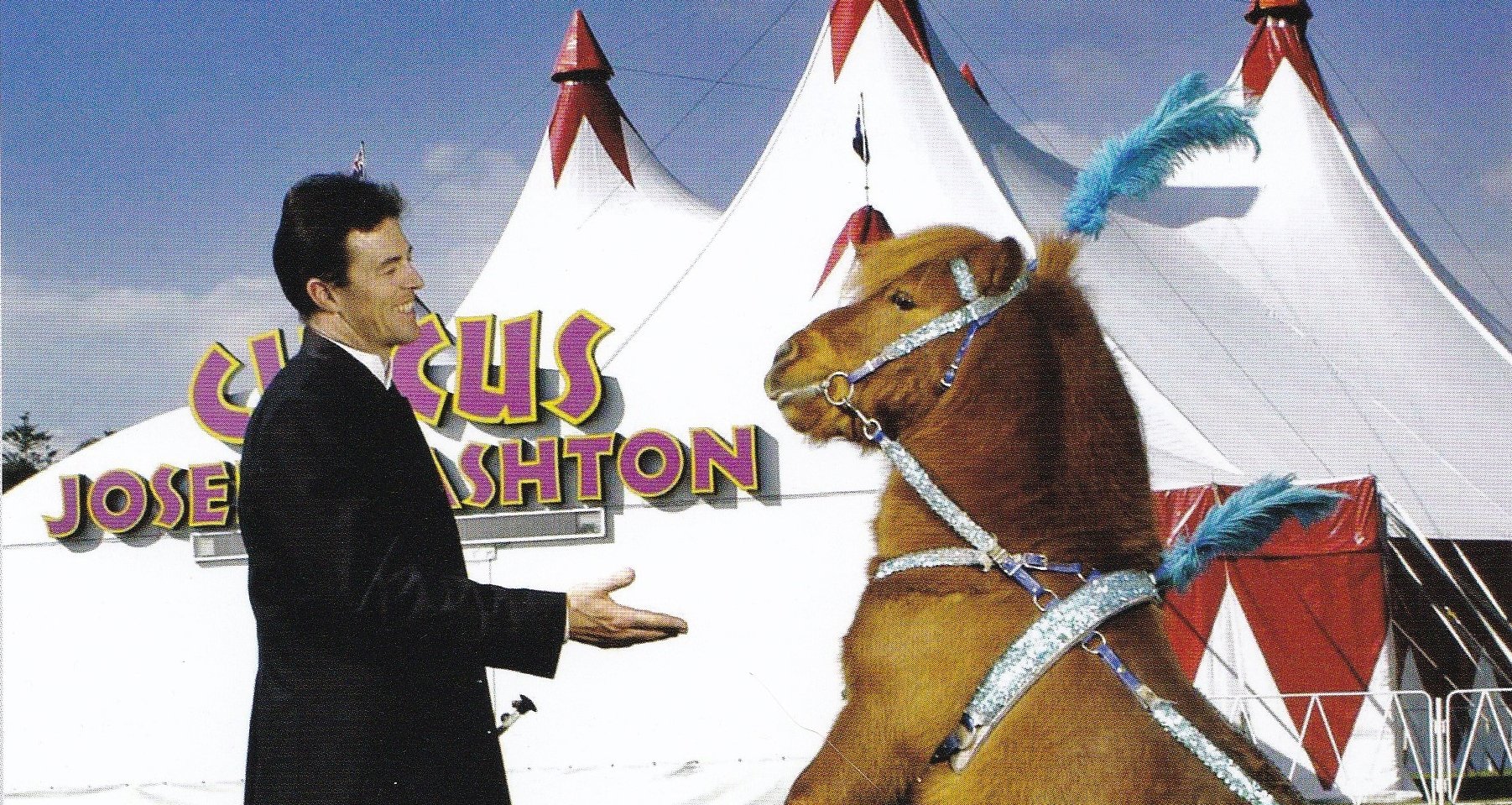
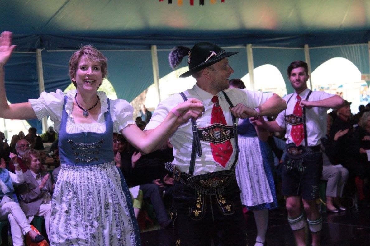

From left: Ashton’s Circus, Shutzenfest, and Soundwave. Some of the many large events staged here in Bonython Park.
This area of Park 27 also played host over a recent summer, to Water Wonderland, an inflatable water theme park.
This open space is within the 19 hectare “Expanded Area” and therefore is subject to the possibility of "large scale excavation works" while the new Women’s and Children’s Hospital is being constructed, up until 2031.
From this point, walk north along the road until you come to a road junction. Turn right there, and go down the hill. Stop at the low wooden bridge crossing the river.

15. Kaurna significance
The area along the Torrens here was set aside in the very first days of the British Colony as being a ‘Native Location’ or ‘Aboriginal Location’.
South Australia was founded as a colony on 28 December 1836 – what’s known as “Proclamation Day” - with a ceremony at Holdfast Bay.
Only a few days later, the first settlement began here in Adelaide, and the first site occupied by Europeans was here in what is now called Bonython Park.
From January to March 1837, migrants camped in tents and temporary wooden huts in two camps in this location.
The camps were named after two of the first migrant ships, the Buffalo and the Coromandel.
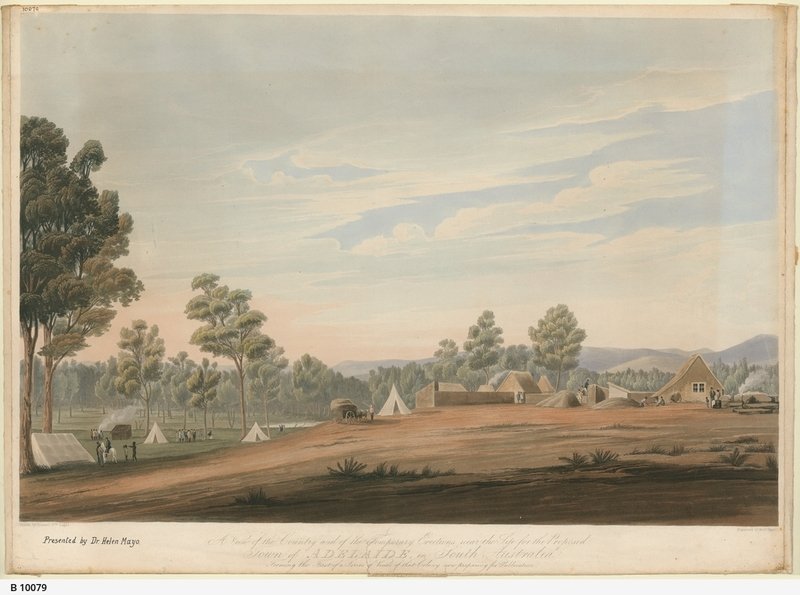
Image: State Library of SA: “Coloured lithograph, drawn by William Light and engraved by Robert Havell, of 'A View of the Country and of the Temporary Erections near the Site for the Proposed Town of Adelaide" in South Australia. Forming the First of a Series of Views of that Colony now preparing for Publication'. The drawing features several small settlers' homes and tents, a hay cart drawn by two oxen, and several groups of settlers and Aboriginal people in the foreground, with the bush and Adelaide Hills in the background.
These camps could be considered Adelaide’s first migrant hostel; a temporary camp, right here for the “boat people”.
The colonial government had the intention of gathering the existing Aboriginal population into one place for the purposes of education provided by missionaries.
Of course it also had the effect of removing the Kaurna people from their traditional lands after thousands of years; lands that were now earmarked for European settlers to live and work.
Between 1837 and 1845 the so-called “Native Location” was set up, and then moved several times.
The first Native Location (“Bromley’s Camp”) was established in April 1837 by Captain Walter Bromley who was appointed ‘Protector of Aborigines’. This was only a few months after the first migrants arrived.
Bromley’s Camp was established, under instruction, by Colonel Light, on land that is now part of Bonython Park. However Bromley’s Camp was little more than a rations distribution point.
A few months later, William Wyatt became the second ‘Protector’ in August 1837 and established a more permanent settlement – in the same vicinity as Bromley’s Camp – south of the river where an acre of land was fenced and contained 12 huts for about 200 aboriginal people.
Two missionaries arrived in October 1838 and established themselves at the old location, where they studied Kaurna language and taught in that language.
Only a year later, in 1839, the Native location was moved again, across to the north side of the river, on what is now part of the Par 3 golf course.

Map by surveyor George Kingston, dated 1842, showing the “aborigines location” that was in use 1839-45
This was called the Pirltawardli site. A school was opened there in December 1840, but the site was dismantled in 1845, and a new ‘Native School’ teaching only in English was set up near what is now Kintore Avenue.

“Schoolroom of the Aborigines” (1841) by William Cawthorne. This was located immediately across the river from Bonython Park, on what is now the Par 3 golf course.
However the name Pirltawardli still exists. It’s the Kaurna word for Possum Place, and also the name for the adjacent Park 1, also known as Possum Park, and the site of the golf courses.
From this point turn south and walk on the path along the river’s edge. Stop where you can get a good view of the next wooden bridge crossing.

16. Landscaping, 1960s
Bonython Park received its English name only in 1962 after it had been landscaped.

John Lavington Bonython (1875-1960)
At that point, it was named in honour of this man: prominent South Australian politician and journalist Sir John Lavington Bonython, who died in 1960. He was the son of John Langdon Bonython.
Bonython Hall on North Terrace (part of Adelaide University), is named after the older Bonython. This Park is named after the younger Bonython.
The name is actually somewhat ironic. In the years just before his death in 1960, John Lavington Bonython was critical of what was being planned here.
He had envisaged a more grandiose scheme for the area, which included creating a second lake as large as the existing Torrens Lake.
You may have heard the name William Veale in connection with the Adelaide Park Lands. Mr Veale was the Town Clerk of Adelaide (today we would call him the Chief Executive) for 18 years: 1947 to 1965, and he left a very significant legacy in your Park Lands.
Together with the Mayor of the time, Arthur Rymill, their efforts are very noticeable throughout the Adelaide Park Lands.
Messrs Rymill and Veale, as leaders of the City Council in the post-war era, were responsible for establishing a lake and other facilities in Rymill Park, and for the landscaping of what we now call Veale Gardens in Park 21 off South Terrace and Bonython Park.
Mr Veale laid out his plans for Park 27 in 1958. At the time, he said this area was like the ‘Siberia of the Park Lands’, and needed to be addressed.
According to newspaper reports of the time, it was regarded as “the most unsightly location in the Adelaide Park Lands”. The banks of the river looked like steep ravines.

Erosion on banks - pre 1960
The Council, led by Messrs Rymill and Veale approved a landscaping scheme, which involved the removal of over 30,000 cubic metres of soil. A series of low weirs was built to form shallow lakes, and the land was transformed into the lawns, picnic grounds and gardens, that you can see today.
The idea was that the shallow lakes could be safe for children, and also used for canoeing, small rowing and pedal boats.
From here, walk along the path to the wooden bridge across the river.

17. Park Lands Trail
Opposite this bridge, and close to your starting point on this Trail, you’ll notice a building made of Carey Gully sandstone, similar to the kiosk. That’s a maintenance shed and electricity substation for the Park.
The bitumen path on which you’ve been walking is just a small segment of the River Torrens Linear Park, which extends for more than 33 kilometres from Athelstone in the foothills, to Henley Beach on St Vincent Gulf .
This is Australia’s longest hills-to-coast path. It is ideal for families wanting to spend time together walking, riding, running or taking the family dog for some exercise.
This part of the River Torrens Linear Park also forms part of the Adelaide Park Lands Trail, which is a series of connected walking and cycling trails which loop both the city of Adelaide and North Adelaide.
There is a proposal to connect up all the different segments of the Park Lands Trail, with tunnels or bridges under or over all of the roads, and install lighting and reflective surfaces.
It’s being promoted as a potential tourist attraction. Come and run, or walk or cycle, all the way around a capital city. It’s being called the “Adelaide Recreation Circuit”.
Its promoter has support from Business SA, the City Council, Bike SA, and others. However, he has not yet been able to secure funding for a feasibility study.
Next to the bridge is an interpretive sign which suggests that this location was probably the site of South Australia’s first commercial garden or nursery. The garden was set up by one of the first settlers, Thomas Allen, a botanist.

Thomas Allen as photographed by his son in 1862. Pic provided to the City of Adelaide by Ian Westergaard
It existed, probably in this location, between 1837 and 1840. A description of the garden, written in 1838 suggested that it was the only piece of ground in the colony that was cultivated and pleasant to roam through, with “its cucumber and melon beds, and solace from the glare and dust of Currie and Hindley Streets.” It was described as being a low, swampy piece of land that had formerly been flooded, and was capable of “producing astonishing crops of of both English and Colonial vegetables”.

Part of Colonel William Light’s 1837 survey map of Adelaide. The area marked “Botanical Garden” (nowhere near the current Botanic Garden) is where Thomas Allen is believed to have established the colony’s first commercial garden nursery.
From this point you can climb the stairs back to your starting point at the Bonython Park kiosk.

18. Return to kiosk - a slaughterhouse site
The Bonython Park kiosk itself stands at, or immediately next to, the site of a two-storey brick slaughterhouse, that stood here for many decades, until 1913.
There was a slaughterhouse here, because it was handy to the site of sheep and cattle yards nearby. The livestock were kept on what is now the site of the Royal Adelaide Hospital.
Slaughterhouse Road ran from North Terrace, behind the livestock yards into what is now Bonython Park.
From the 1850s until the 20th century, the City Council’s major income derived from the Park Land was from the slaughterhouse and cattle market.
In 1913, the council was able to expel the cattle market from the Park Lands after 65 years and relocate it to Gepps Cross. The yards were seen as damaging to the Park Lands and the aesthetics of the city. The noise, dust and smells from the many cattle and sheep was no longer acceptable.
After the slaughterhouse was torn down, in 1913, the site remained vacant for 50 years.
The kiosk was built in 1963. Therefore in the 1960s, when the kiosk was built, few people associated the site with the former slaughterhouse.
Optional: download and print a tri-fold leaflet, i.e. a double-sided single A4 page, with a brief summary of this Trail Guide: (PDF, 1.7 Mb)
All of our Trail Guides and Guided Walks are on the traditional lands of the Kaurna people. The Adelaide Park Lands Association acknowledges and pays respect to the past, present and future traditional custodians and elders of these lands.

